India sits on a dynamic planet with layers of earth formed over hundreds of millions of years. Starting from , deep sea beds shifted, supercontinents cracked apart, and giant volcanoes poured out molten lava to build the landmass we live on today. By studying core terms like Paleozoic, Gondwana, and Deccan Trap, we can uncover how ancient seas turned into soaring mountain peaks like Mount Everest and where India stores almost all of its coal resources.
🎯 In this chapter, you will understand:
- How the Dravidian and Carboniferous rock systems were formed millions of years ago in ancient marine environments.
- The main geological eras making up the vast Aryan Rock System, spanning from early coal ages to modern landmasses.
- Why the Gondwana rock layers contain almost all of India’s coal reserves and how ancient river valleys trapped rich organic material.
- How massive volcanic eruptions formed the Deccan Traps and created fertile black cotton soil called regur.
💡 Why this topic matters: Learning about rock systems helps us locate valuable natural resources like coal, iron ore, and building stones. It also explains how physical landscapes like the Himalayas, Gangetic plains, and Deccan plateau were formed over millions of years.
🧠 Core Idea: Earth's crust changes over vast spans of time through marine flooding, continental drift, volcanic outpourings, and mountain building, leaving behind distinct rock layers that act as a timeline of our planet's history.
📌 Other Rock Systems Overview
Below the surface of India lies a complex tapestry of rocks formed during different geological eras. Beyond the oldest ancient foundations, these secondary and tertiary rock systems tell the story of rising ocean waters, ancient river lakes, and massive volcanic flows across the Indian subcontinent.

Dravidian Rock System (Paleozoic)
The Dravidian Rock System was created during the Paleozoic era, which stretched from to . Because of its timing, scientists also refer to it as part of the Carboniferous rock system timeline. During this ancient epoch, large parts of the land were submerged under seawater, creating ideal conditions for underwater mud and sand to settle into solid layers.
- (i) It is found mostly in extra-Peninsular areas like the high Himalayas and parts of the Gangetic plain rather than the central plateau.
- (ii) The rocks in this system include shales, sandstones, soft clays, and hard quartzites.
Carboniferous Rocks (350 million years ago)
Around , during the Carboniferous age, marine waters covered deep areas of the land. Shells, mud, and ocean debris squeezed together over time to create thick stone layers. Interestingly, the high rocks right at the peak of Mount Everest consist of limestone formed during this Upper Carboniferous period. Although this era marked the start of worldwide coal creation, India does not hold large deposits of coal from this specific timeframe.
- (a) Composed primarily of limestone, soft shale, and tough quartzite.
- (b) Marine conditions prevailed during this period, leaving behind clear fossil evidence inside these formations.
- (c) Mount Everest consists of Upper Carboniferous limestone layers that were pushed skyward millions of years later.
- (d) Coal formation began during this global age, though Indian coal reserves mostly came later.
📌 Aryan Rock System Overview
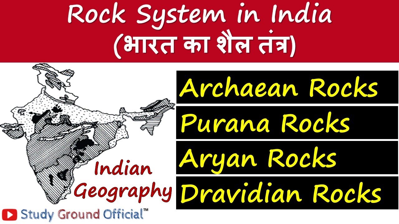
The Aryan Rock System began forming during the Upper Carboniferous period and continues right up to our present era, known as the Holocene. It represents the most recent and long-lasting phase of rock building in India, witnessing the rise of giant dinosaurs, massive volcanic eruptions, and the birth of the Himalayan mountains.
- The Aryan Group of Rock Formation is classified into four major geological eras:
- (i) Upper Paleozoic Era: Covers the Upper Carboniferous and Permian periods, setting the foundation for major land shifts.
- (ii) Mesozoic Era: Includes the Triassic, Jurassic, and Cretaceous periods, featuring the famous Gondwana rock system, Deccan lava traps, and Jurassic sea beds.
- (iii) Cenozoic Era: Spans the Paleocene, Eocene, Oligocene-Miocene, and Pliocene periods when modern mountain chains began rising.
- (iv) Neozoic Era: Includes the Pleistocene and recent Holocene periods, forming our present-day river plains and fertile soil layers.
Gondwana System
The Gondwana System gets its name from the ancient Gond tribes who lived in regions of Telangana and Andhra Pradesh. Starting during the Permian period around , giant cracks and trough-like valleys sank down on the old plateau surface. Rivers dumped leaves, trees, and mud into these sinking freshwater basins for millions of years, trapping huge amounts of organic material under heavy weight.
- (i) Formed in sunken river valleys and basins across ancient plateau surfaces.
- (ii) Accumulation of river sediment caused gradual sinking of the troughs, supporting thriving freshwater plants and land animals.
Gondwana Coal
Because so many lush prehistoric forests were buried inside these sinking river valleys, the Gondwana layers became India's main energy storehouse. Today, this single rock system holds nearly 98% of India’s total coal reserves. While this coal is younger than the Carboniferous coal found in Europe and North America and contains a bit less pure carbon, it is incredibly valuable for industries.
- (i) Holds almost all of India's natural coal deposits.
- (ii) Contains younger coal with lower carbon content compared to older European Carboniferous coal.
- (iii) Rich in essential metals and minerals like iron ore, copper, uranium, and antimony.
- (iv) Strong sandstones, slates, and coarse conglomerates from this system are mined for durable building materials.
Jurassic System
During the latter part of the Jurassic period, shallow ocean waters spilled over western and eastern parts of India—an event known as marine transgression. As these shallow seas temporarily covered land areas like Rajasthan, Kuchchh in Gujarat, and regions on the east coast, marine creatures and sea sediments settled to form distinct rock beds.
- (i) Shallow ocean flooding deposited layers of coral limestone, sandstone, shales, and pebbly conglomerates in Rajasthan and Kuchchh.
- (ii) Another sea transgression left similar marine sediments on the east coast between Guntur and Rajahmundry.
Deccan Trap
Near the end of the Cretaceous period and continuing into the early Eocene era, deep cracks opened up in Earth's crust across western India. Giant volcanic vents poured out huge floods of liquid basaltic lava over hundreds of thousands of years. As lava layer stacked upon lava layer, it created flat-topped hills with steep step-like sides, known as the Deccan Trap (from the Swedish word for steps).
- (i) Originally covered massive lava fields spanning ten lakh square kilometers across central and western India.
- (ii) Long-term weathering by rain and wind reduced its surface area over millions of years to about five lakh square kilometers today.
- (iii) The lava layers vary in thickness from 3,000 meters in the west near Mumbai down to 150 meters at its eastern boundaries.
- (iv) Natural breakdown of basalt rock created the ultra-fertile black cotton soil widely known as regur.
- (v) The Deccan Trap is divided into three distinct structural groups:
- (a) Upper Trap: Located primarily in Maharashtra and Saurashtra with volcanic ash beds.
- (b) Middle Trap: Found across Central India and the Malwa region.
- (c) Lower Trap: The oldest layer containing inter-trappean sediment beds between lava flows.
📌 Tertiary System
The Tertiary System spans a crucial timeframe from the Eocene to the Pliocene epoch, lasting from about to . During this active era, the ancient supercontinent of Gondwana finished breaking apart. The Indian landmass drifted northward and crashed into the giant Eurasian plate, crumpling the sea floor between them and lifting up the towering Himalayan mountain chain.

Diagram illustrating Tertiary rock layers and Himalayan mountain uplift. Geographic Distribution & Key Formations
Tertiary rock structures played a central role in shaping the modern physical map of India. They are widely distributed across the country in both mountain ranges and river basins.
- (i) Found across the Bengal and Ganges deltas, the East coast, Andaman Islands, Salt Range, Potwar Plateau, Jammu, Punjab, Assam, Sind, and Baluchistan.
- (ii) Includes unique rock formations such as the lake-bed deposits called Karewas in Kashmir valley.
- (iii) Formed the older river deposits called Bhangar and newer river silt called Khadar across the northern Gangetic plains.
📌 Geological History Summary
The overall geological journey of India is a remarkable story of continental travel. Millions of years ago, the land block called the Indian Craton sat as part of the massive supercontinent Pangaea. When the southern half—Gondwanaland—broke apart around , India began floating north across ancient oceans.
- (i) The Indian landmass separated from Gondwanaland around and drifted north toward Eurasia.
- (ii) The collision between the Indian plate and Eurasian plate around pushed up the Himalayan mountains.
- (iii) River silt filling the deep trough south of the Himalayas formed the vast Indo-Ganga-Brahmaputra plain during the upper Pliocene and Pleistocene periods.
- (iv) Today, India contains rocks from almost every single geological age, creating incredible landscape variety across its regions.
⚡ Quick Revision Capsule: Indian Rock Systems Summary
Here is a quick comparison table summarizing the main geological rock systems of India, their formation ages, and key natural characteristics.
| Rock System | Geological Era & Age | Key Features & Economic Value |
|---|---|---|
| Dravidian System | to (Paleozoic) | Marine fossils, shales, and limestone; found in Himalayan regions like Mount Everest. |
| Gondwana System | Starts (Permian period) | Sunken river basins; contains nearly 98% of India's coal reserves along with iron ore and sandstone. |
| Jurassic System | Mesozoic Era (Jurassic Period) | Shallow sea deposits in Rajasthan and Kuchchh; rich in coral limestone, shales, and sandstone. |
| Deccan Trap | End of Cretaceous to early Eocene | Massive basaltic lava flows; weathered over time to form fertile black cotton regur soil. |
| Tertiary System | to (Eocene to Pliocene) | Linked to the rise of Himalayas; includes Kashmir Karewas and plain soils like Bhangar and Khadar. |
📝 Summary
India’s geological history spans hundreds of millions of years, moving from underwater ocean beds during the Dravidian era to river valley sinkings during the Gondwana period. Massive volcanic basalt flows formed the Deccan Traps, while the northward drift of India crumpled ocean floors to lift the Himalayas during the Tertiary period (). Together, these geological events produced rich soils, mountain barriers, and vital mineral reserves across the Indian subcontinent.
🚀 Quick Revision Points
Essential facts to review before examinations:
- (i) The Dravidian rock system formed under ancient sea waters during the Paleozoic era.
- (ii) The top layers of Mount Everest are made of Upper Carboniferous limestone.
- (iii) Gondwana rocks hold almost 98% of all coal reserves found in India.
- (iv) Basalt lava flows formed the Deccan Trap, which breaks down into black cotton regur soil.
- 💡 Exam Tip: Remember that Gondwana coal is non-Carboniferous (younger than European coal) and formed in sunken freshwater river troughs, while the Deccan Traps formed from fissure volcanic eruptions at the end of the Cretaceous period!
❓ Frequently Asked Questions (FAQ)
Q1: Why are Gondwana rocks so famous in Indian geology?
A1: Gondwana rocks are famous because they contain nearly 98% of India's total coal reserves, alongside valuable iron ore, copper, and building sandstone.Q2: What created the black soil of the Deccan Plateau?
A2: The black soil, known as regur, was created by millions of years of wind and rain weathering down the basaltic lava rocks of the Deccan Trap.Q3: When and how did the Himalayan mountains form?
A3: The Himalayas formed during the Tertiary system (around ) when the drifting Indian landmass collided into the Eurasian plate, pushing up squeezed marine sediments.