Understanding planet Earth involves learning about its shape, how it moves in space, and how we measure location and time. From adjusting our clocks during daylight saving hours to watching an eclipse unfold, the natural systems of our home planet influence daily life across the globe.
🎯 In this chapter, you will understand:
- How daylight saving time works and why Earth is called the blue planet.
- The difference between rotation and revolution, along with leap years and critical solar positions.
- How lines of latitude and longitude help us find places and calculate local times.
- Why time zones, standard time, and the International Date Line exist, and how solar and lunar eclipses occur.
💡 Why this topic matters: Knowing how Earth spins and travels around the Sun explains our daily weather changes, seasonal patterns, clock settings, and global time differences.
🧠 Core Idea: Earth is a dynamic planet whose shape, tilted axis, and space movements shape our climate zones, time standards, and regular calendar cycles.
Day Light Saving (DST) & Earth
Daylight Saving Time (DST) is the practical system of shifting clocks forward by one hour in warm summer months. Moving clock time ahead lets people make better use of extra evening sunlight. This standard practice is mostly used in mild temperature regions, helping shops, outdoor sports, and overall energy consumption by reducing reliance on electric indoor lighting during evenings. However, shifting local clock settings can sometimes create brief disruptions in time keeping schedules and automated systems.
- Our home world, planet Earth, remains the only planet currently known to support living organisms.
- Around two-thirds of the planet's surface is covered by liquid water, giving it the famous nickname blue planet.
- It stands as the third planet outward from the Sun, holds the position as the densest planet in our solar system, and represents the largest body among the four inner rocky planets.
- When comparing overall physical size, Earth ranks as the fifth-largest planet across the solar system.
- The sphere is slightly flattened at the top and bottom poles, giving it a special geoid shape, which simply means a real earth-like shape.
Size and Shape of the Earth
The true physical form of our planet is not a perfect smooth ball. Scientists use a specific term to describe its true contours accurate to real measurements.

- The shape of Earth is formally called a geoid, which translates to an earth-like shape.
- The planet is slightly flattened at the North Pole and South Pole, while it bulges out around the middle equator due to spinning forces known as centrifugal force.
- Because speed and movement differ between the wider middle equator and the narrow polar ends, the planet maintains a slightly non-spherical outline.
Motions of the Earth
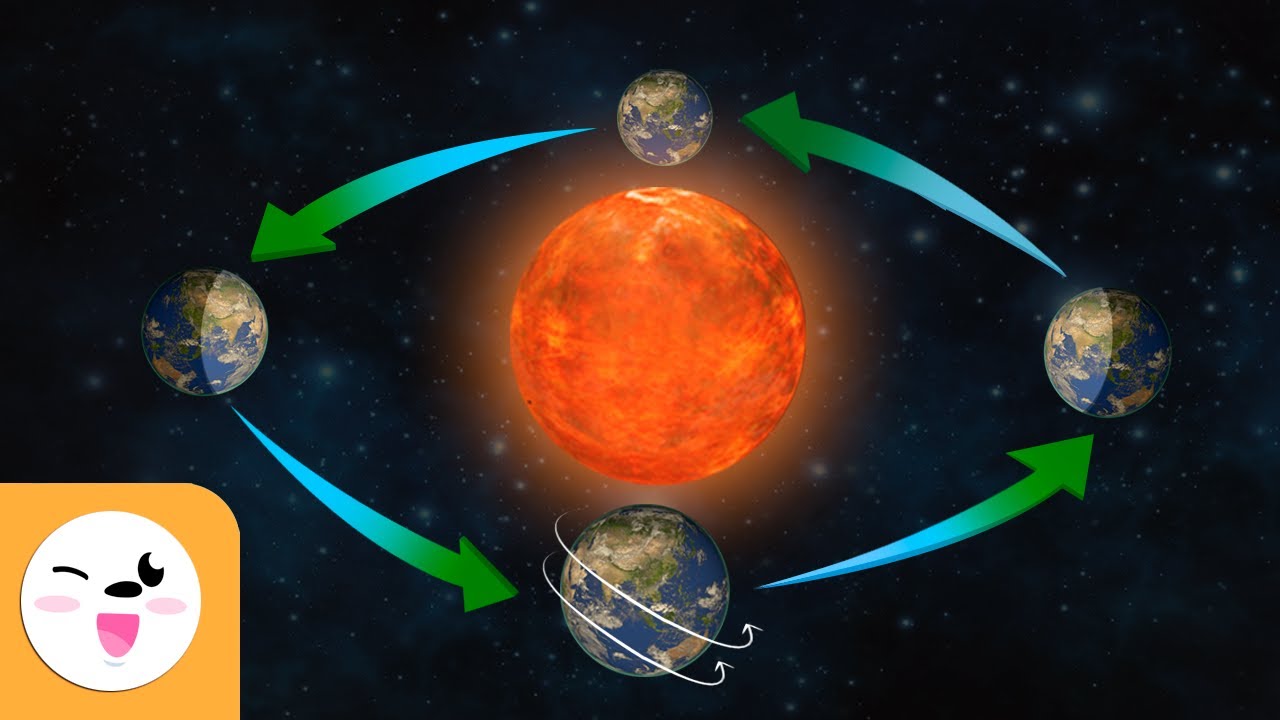
The planet experiences two main regular movements: rotation and revolution. Planetary rotation happens as the world spins around its internal central line from west toward east, taking about to complete one turn, creating regular day and night. Meanwhile, planetary revolution describes Earth moving along a long pathway around the Sun. This space journey requires , which adds up to create an extra leap day every .
- Our planet stays in constant motion, both traveling around the Sun and spinning on its axis.
- Rotation: The planet spins on its invisible line from west to east (counter-clockwise direction). A complete turn takes precisely , creating the steady cycle of daylight and dark nights.
- Revolution: Earth circles around the Sun in a counter-clockwise path, taking to finish one full loop. Earth's space path or orbit is shaped like a slightly stretched oval, and the average distance to the Sun measures about 93 million miles.
Changes in day and night lengths across different seasons happen because Earth rotates on a slanted center line while revolving around the Sun. This tilted journey brings seasonal weather changes and varies the total hours of sunlight places receive throughout the year.
Leap Year
The orbit of Earth around the Sun takes to finish, bringing seasonal shifts throughout the year. To keep calendars aligned with space movements, a leap year occurs every by adding an extra day into February.
- The extra six hours left over each year add up over four cycles to make one full day (), giving a leap year total.
Earth Rotates in an Elliptical Orbit around the Sun
Earth turns on its axis from west to east over a span, continuously moving areas into light and darkness. The dividing line separating the bright day side from the dark night side on the globe is named the circle of illumination. Earth's central axis rests tilted at an angle of 23.5 degrees, which changes daylight hours around the globe.
Orbital positions change Earth's distance from the Sun during perihelion and aphelion. - Earth's pathway around the Sun is oval-shaped or elliptical, causing distances between the Sun and planet to change during the year.
- Perihelion: The point where Earth comes closest to the Sun, occurring around .
- Aphelion: The point where Earth reaches its farthest distance from the Sun, occurring around .
- Earth's axis points steadily toward a fixed position in space near the North Star (or polar star), causing direct sunlight angles to move north or south across the year.
Earth's Critical Positions
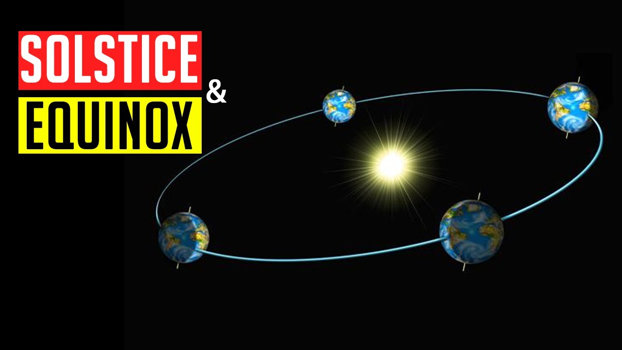
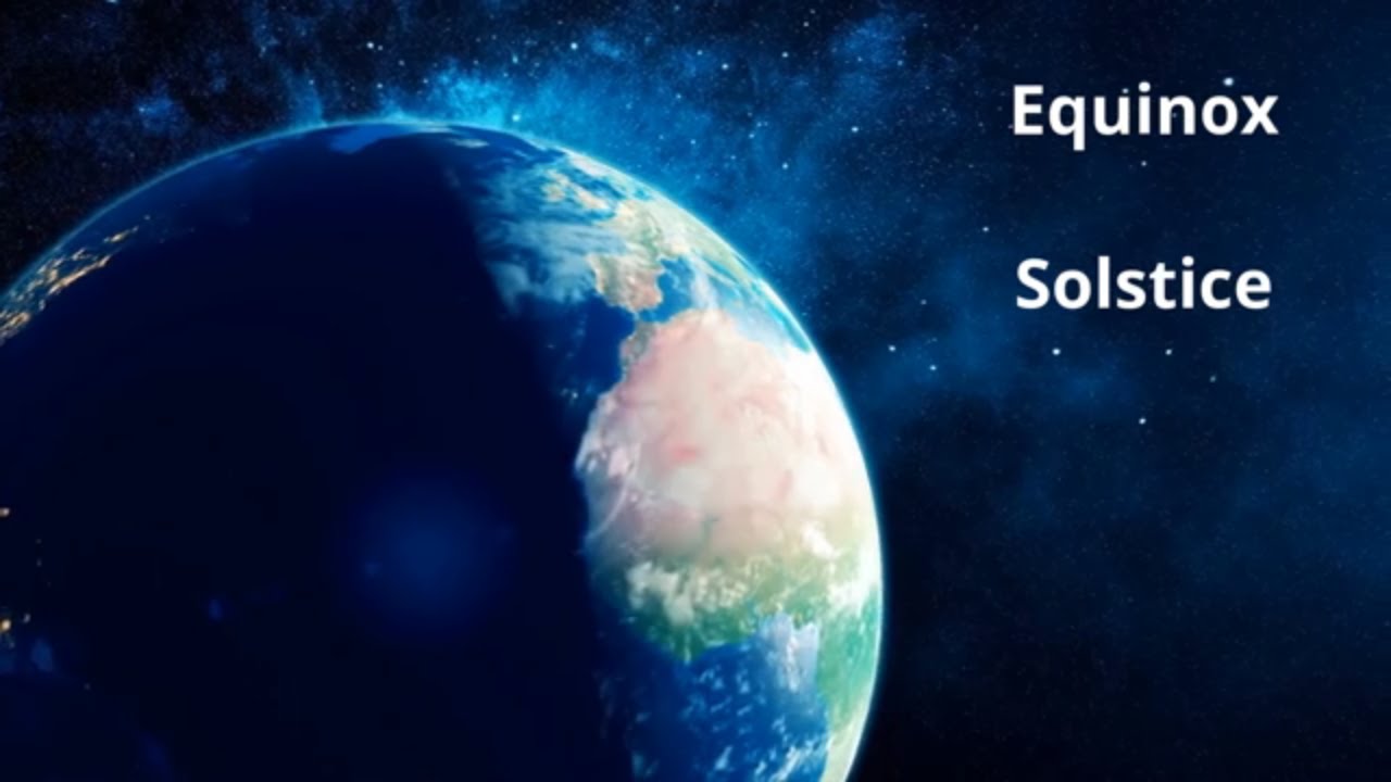
An equinox takes place twice every year, around and . On these dates, direct sunlight hits straight along the central equator line, making day and night equal lengths everywhere on Earth. During an equinox, the northern side of Earth enters spring around and autumn around , while the southern side experiences the exact opposite seasons.
- Equinoxes: On and , direct rays hit straight over the equator, creating equal daylight and darkness across the planet.
Around , the northern half of Earth leans toward the Sun, bringing warm summer months and the longest daylight stretch of the year. Meanwhile, the southern half leans away, entering winter with shorter daylight hours. On , direct sunlight shifts to fall straight over the southern line known as the Tropic of Capricorn, starting summer in the south and winter in the north.
- Summer Solstice: On , sunlight strikes directly over the Tropic of Cancer, granting longer day hours to the northern hemisphere.
- Winter Solstice: On , sunlight strikes directly over the Tropic of Capricorn, causing longer night hours in the northern hemisphere.
Why Days Are Longer than Nights at the Equator
Earth's air layer, or atmosphere, bends light rays through a process called light refraction. This bending shifts how early we see sunrise and how late sunset appears. Light refraction acts strongest near morning and evening horizons, making total daytime slightly longer than night hours along the equator than it would be without air.
Temperature and Latitude
Air temperatures drop as you move farther away from the central equator toward higher latitudes due to Earth's curved shape. Equatorial areas receive straight, focused sunlight, whereas polar regions receive slanted sunlight spread across wider spaces. Because heat spreads out more near the poles, energy per unit area decreases moving north or south from the equator.
Latitudes and Longitudes
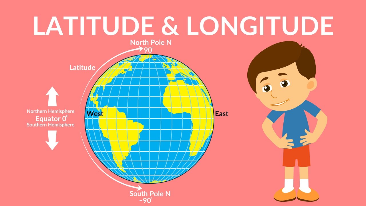
Latitude and Longitude are grid lines drawn on globes to pinpoint exact locations across Earth's surface. Because the real planet forms a geoid, geometric grid systems provide exact coordinates.
Example: The location coordinates for the city of New Delhi are written as 28° N latitude and 77° E longitude.
- Latitude measures angular distance north or south from the central equator line, starting from the center of Earth.
- Because the planet flattens slightly near both poles, one degree of latitude covers slightly longer real distances at the polar ends than near the equator. For instance:
- At the Equator (0°), one degree spans about 68.704 miles (111 km).
- At 45° latitude, one degree spans about 69.054 miles (111 km).
- Near the poles, one degree spans about 69.407 miles (111 km).
- The global average distance for one degree of latitude measures about 69 miles (111 km), where 1 mile equals roughly 1.607 km.
Important Parallels of Latitude
Along with the Equator line (0°), the North Pole (90° N), and the South Pole (90° S), mapmakers track four major reference lines of latitude:
- (i) Tropic of Cancer located at 23½° N in the northern hemisphere.
- (ii) Tropic of Capricorn located at 23½° S in the southern hemisphere.
- (iii) Arctic Circle situated at 66½° N of the Equator line.
- (iv) Antarctic Circle situated at 66½° S of the Equator line.
Latitudinal Heat Zones of the Earth
Sunlight angles shape different climate areas across Earth's surface based on distance from the equator.
- (i) The midday sun shines directly overhead at least once per year across all locations resting between the Tropic of Cancer and Tropic of Capricorn. This middle belt gets the most sunlight heat and is called the Torrid Zone.
- (ii) The midday sun never stands straight overhead beyond the Tropic of Cancer or Tropic of Capricorn. Sun rays strike at sharper angles closer to the poles. Middle areas between the Tropic of Cancer and Arctic Circle in the north, and between the Tropic of Capricorn and Antarctic Circle in the south, experience mild climate conditions. These areas are called Temperate Zones.
- (iii) Regions reaching from the Arctic Circle to the North Pole, and from the Antarctic Circle to the South Pole, stay freezing cold. Sunlight arrives at steep slanting angles without rising high above the horizon line. These frozen areas are called Frigid Zones.
Heat Zones of the Earth
Summary of climate belts based on sun heat distribution:
- (i) Torrid Zone: Positioned between 23½° N and 23½° S, receiving maximum annual sun heat.
- (ii) Temperate Zones: Located between the Tropics and Polar Circles, keeping moderate average temperatures.
- (iii) Frigid Zones: Located surrounding polar caps, staying extremely cold due to low-angled sunlight.
Additional Key Points about Latitude
Quick structural rules governing latitude lines:
- (i) Lines of latitude travel side-to-side (horizontally) around the globe.
- (ii) The Equator line marks the 0° starting baseline.
- (iii) The North Pole stands at 90° N, while the South Pole marks 90° S.
- (iv) Mapmakers draw 180 total parallel lines, which shorten in circle length toward polar ends.
Longitude measures angular distance in degrees east or west along the equator baseline starting from a prime zero line. On a globe, longitude lines form half-circles stretching from pole to pole. These up-and-down lines are also called meridians.
Important Longitudes
Unlike the equator which rests naturally midway between poles, any meridian could have served as zero. In , international leaders agreed to pick the meridian passing through the Royal Astronomical Observatory at Greenwich near London as the zero line, naming it the Prime Meridian (0°).
- (i) Meridians draw closer together as they approach polar ends, narrowing space between lines.
- (ii) Longitude lines prove vital for calculating local solar time relative to Greenwich Mean Time (G.M.T.), often referred to as World Time.
Longitude and Time
Because Earth turns a full circle of 360 degrees over , it rotates through 15 degrees of longitude each hour, or 1 degree every .
- (i) Earth turns from west to east, meaning places farther east see sunrise earlier. Local time moves forward by for every 15 degrees traveled east, while moving west sets local time back by .
- (ii) Places east of the Prime Meridian at Greenwich gain time, while places west lose time.
- (iii) Knowing G.M.T. allows anyone to calculate local times by adding or subtracting time based on longitude differences.
Longitude
Structural traits of up-and-down grid lines:
- (i) Lines of longitude run vertically from top to bottom and are called meridians.
- (ii) The Prime Meridian situated in Greenwich, England, marks 0° Longitude.
- (iii) Earth is divided into 180 degrees east longitude and 180 degrees west longitude.
Longitude and Time Overview
How planetary rotation sets local clocks:
- (i) The Prime Meridian in Greenwich sees the Sun reach its highest sky point at noon.
- (ii) Earth's spinning motion creates local time shifts; eastern regions run ahead of Greenwich time while western regions run behind.
- (iii) The planet turns 360 degrees across , spinning through 15 degrees during each hour.
Standard Time and Time Zones
If every town set clocks by local noon angles, travel between nearby places would bring constant confusion. Travelers would need to adjust watches continuously, making schedules hard to keep.
- (i) To prevent time confusion, nations adopt a unified standard time system.
- (ii) Most countries set standard time using a main central meridian line crossing their territory.
- (iii) Broad nations spanning wide distances—like Canada, USA, China, and the former USSR—use multiple time zones instead of a single clock setting.
- Canada and the USA use five standard time zones: Atlantic, Eastern, Central, Mountain, and Pacific Time Zones. The time difference between Atlantic and Pacific coasts spans nearly .
- The former USSR maintained eleven distinct time zones, while modern Russia uses nine time zones.
- (iv) In India, the central baseline is fixed at 82½° E longitude, establishing Indian Standard Time (IST).
- (v) Globally, Earth is split into 24 standard time zones, each spanning 15 degrees of longitude.
Chaibagaan Time
Around , British colonial planners created a special work schedule called chaibagaan time (or bagaan time) for tea plantation workers in eastern regions. Setting clocks ahead of IST helped plantations maximize natural morning sunlight to boost daily farm output.
- Following national independence, the state of Assam joined the rest of India in using single IST standards for over .
- Although local leaders in Assam once suggested switching back to Chaibagaan time to conserve energy, national authorities decided to maintain one standard IST time zone.
The International Date Line
Traveling east gains time relative to Greenwich until reaching 180°E, where local clocks run ahead of G.M.T. Moving west loses time until 180°W, running behind G.M.T. This creates a full day difference across opposite sides of the 180° line.
- The International Date Line (IDL) sits along the 180° longitude line in the ocean.
- Crossing the line toward the east causes you to subtract a day, while crossing toward the west adds a day to your calendar.
- To avoid splitting island nations into two different days, the boundary bends around land areas like the Bering Strait, Fiji, and Tonga.
Why is the International Date Line drawn in a zigzag manner?
Reasoning behind the bent boundary line across the ocean:
- (i) The International Date Line passes through open waters of the Pacific Ocean as an imaginary boundary line. Because time differs by across it, crossing changes your calendar date.
- (ii) Island groups like Polynesia, Melanesia, and Micronesia spread across wide ocean areas. If the line were drawn perfectly straight, parts of the same country could live on different days. Drawing a zigzag line through open ocean waters prevents administrative calendar confusion.
⚡ Quick Revision Capsule: Earth's Grids, Motions & Time Standards
This reference summary details core scientific measurements, planet motions, and geographic boundary rules.
| Feature / Concept | Key Measurement / Location | Primary Geographic Result |
|---|---|---|
| Earth Shape | Flattened poles, equatorial bulge (geoid) | Varying degree lengths for latitude |
| Planet Rotation | West to East; | Daily cycle of day and night |
| Planet Revolution | Oval orbit; | Creates four seasons and leap years |
| Prime Meridian | 0° Longitude (Greenwich Observatory) | Base starting line for global G.M.T. time |
| International Date Line | 180° Longitude (Zigzag ocean path) | Changes calendar dates by exactly |
Eclipses
An eclipse happens when one space body passes into the shadow of another space body, temporarily blocking light views from Earth.
- Solar Eclipse: Occurs when the Moon moves directly between Earth and the Sun, blocking part or all of the Sun from view. Types include:
- (i) Total solar eclipse
- (ii) Annular solar eclipse
- (iii) Partial solar eclipse
- (iv) Hybrid solar eclipse
- Lunar Eclipse: Occurs when Earth positions directly between the Sun and Moon, casting a dark planetary shadow over the Moon.
Because Earth rests on a tilted axis, regions located past the Arctic Circle receive continuous sunlight during summer months. Leaning toward the Sun keeps polar areas inside light zones continuously for about .
📝 Summary
Earth is a dynamic geoid planet that spins on a tilted axis every while traveling around the Sun over . This combination of rotation and tilted revolution shapes daily day-night cycles, seasonal variations, climate heat zones, and calendar leap years. Imaginary grid lines of latitude and longitude allow us to navigate Earth's surface and calculate time shifts. Globally, time is organized into 24 standard time zones linked to the Prime Meridian at Greenwich, while crossing the zigzag International Date Line shifts calendar dates by . Finally, shadow alignments between the Sun, Earth, and Moon bring solar and lunar eclipses.
🚀 Quick Revision Points
Essential facts to review before examinations:
- (i) Earth's true shape is a geoid, bulging at the middle equator and flattening near the poles.
- (ii) Rotation spins west to east in , while revolution takes .
- (iii) The Torrid Zone sits between 23½° N and 23½° S, getting direct sun heat.
- (iv) Crossing the International Date Line at 180° longitude changes the date by one full day.
- 💡 Exam Tip: Remember that moving east across longitudes adds time (15° = 1 hour ahead), while moving west subtracts time.
❓ Frequently Asked Questions (FAQ)
Q1: Why does a leap year have 366 days?
A1: Earth takes to orbit the Sun. The extra 6 hours saved each year add up over to make one full extra day (), which is added to February.Q2: What is the difference between the Torrid Zone and Temperate Zones?
A2: The Torrid Zone receives direct overhead sunlight and maximum heat, while Temperate Zones receive slanted sun rays and experience mild temperatures.Q3: Why is the International Date Line drawn in a zigzag pattern?
A3: It zigzags through ocean waters so that island groups and countries are not split into two different calendar days.