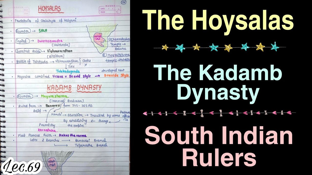
The historical trajectory of the Hoysala Dynasty forms a crucial chapter for students and candidates preparing for major competitive history and civil service examinations. Flourishing as a dominant political and military force in South India from the 11th to 14th centuries, this prominent empire originally emerged from the picturesque Kannadiga region. With Belur serving as their foundational seat of power, the Hoysalas cleverly filled the political void created by the reciprocal weakening of older regional giants. Over many decades of strategic warfare, marital alliances, and robust governance, they carved out a formidable kingdom, eventually shifting their administrative hub to the magnificent capital of Halebidu. Their structural legacy stands as a monumental link in the evolution of Deccan statehood, concluding with intense historic encounters against external northern expeditions.
In this chapter, you will understand:
- The geopolitical transition of the Hoysalas from modest regional feudatories into absolute rulers of the Kannadiga region.
- The military triumphs of Vishnuvardhana and the precise imperial boundaries mapped by the legendary Belur Record.
- The complex network of diplomatic marital agreements engineered by later sovereigns to check expansionist neighbors.
- The internal successional structural friction and subsequent catastrophic military strikes led by Malik Kafur that brought down the empire.
Why this topic matters: Analyzing the Hoysala line highlights how regional principalities utilize complex diplomatic dynamics, shift administrative capitals to consolidate authority, and manage balance-of-power equations across medieval South India.
Core Idea: The story of the Hoysalas details a systematic ascent from local warriors to supreme sovereigns. Through calculated regional containment of old rivals and intensive military positioning, they reached a peak of absolute dominance before internal divisions opened the door to the historic forces of the Delhi Sultanate.
The Rise, Expansion, and Administration of the Hoysala Dynasty in South India (11th–14th Century)
The rise of the Hoysalas of Dwarsmudra as a brilliant regional entity was heavily accelerated by the ongoing political instability across South India. Originating as local sub-rulers, they leveraged structural vulnerabilities among dominant neighbors to expand their sovereign footprint safely over time.
Strategic Positioning Amid Competitors: The Hoysalas navigated a complex field of powerful regional entities who continuously fought for supreme control over the Deccan peninsula.
- (i) The primary regional powers competing at that time included the Western Chalukyas of Kalyani, the Cholas, the Pandyas, the Kakatiyas to the east, the Kalachuris, and the formidable Yadavas of Devgiri in northern Karnataka.
- (ii) Their initial political center of gravity was established at Belur, which hosted their primary cultural and early military programs, before imperial expansion prompted a shift to Halebidu.
- (iii) The rapid structural deterioration of once-invincible deep-southern powers like the Cholas and Pandyas opened up a perfect geopolitical vacuum that the Hoysalas quickly stepped into.
Early Founders and the Consolidation of Hoysala Territory
The foundations of this resilient line were built by early chieftains who systematically scaled up their lands from minor holdings into a cohesive, recognizable kingdom.

Nripa Kama II: The Initial Founder of the Hoysala Lineage
The physical political lineage of the Hoysala rulers truly began with Nripa Kama II, who operated as a dependable subordinate ally alongside the Western Gangas.
- (i) Following his initial work, his immediate successor, Vinayaditya, launched widespread operations to expand Hoysala influence by systematically subduing various stubborn local clans.
- (ii) These targets consisted primarily of independent Malnad chiefs hailing from specialized forest tracts like Kongalvas, Chengalvas, and the Sandharas located near Humcha inside Shimoga.
- (iii) He also defeated the independent Kadambas of Bayal-nadu (situated in modern Wynad), a foundational expansion later verified by historical records left behind by Ballal I.
Vishnuvardhana: The Real Architect of the Hoysala Empire
While the line traced its lineage to early chieftains, it was under the brilliant rule of Vishnuvardhana that the realm definitively transitioned into an extensive imperial power through masterful military campaigns.
Vishnuvardhana’s Military Victories and Defined Territorial Boundaries
His sweeping expansion strategies established his historic reputation as an unbeatable general who permanently disrupted the old geopolitical maps of South India.
Epigraphic Evidence of Conquest
Detailed contemporary epigraphs reveal the deep psychological and physical impact of his campaigns across adjacent territories.
- (i) The famous Ariskere inscription dating to 1197 CE directly describes him as a "devouring epidemic to Chera," showing his severe impact on their home regions.
- (ii) Confirming this, the distinct Channarayapatna record of 1190 CE notes that he had completely "broken down the bones of Chera-Kerala."
- (iii) His forces seized high-altitude tracts like Ananale within the Western Ghats and Elumale (modern Ezhimala close to Kannur), bringing Bayal-nadu firmly under his sway.
Defining the Hoysala Empire Boundaries as per the Belur Record
A benchmark historic public engraving discovered at Belur, carved in 1185 CE, leaves a detailed geographical record of the vast imperial limits established under his rule.
- (a) Southern Border: The administrative reach ran deeply into southern fields, pushing right against the borders of Kongu.
- (b) Eastern Frontier: Sovereign control cut completely across the peninsula, terminating at the historic city of Kanchi.
- (c) Northern Extent: Territorial authority stopped at the major watering channels of the River Krishna and River Venna.
- (d) Western Edge: The imperial borders met the natural coastline along the shores of the Arabian Sea.
Subduing the Cholas, Pandyas, and the Last Perumal of Mahodayapuram
Through Vishnuvardhana's continuous strategic maneuvers, the historic sway of both the Cholas and Pandyas was substantially reduced.
- (i) The immense structural pressure exerted by the Hoysala forces forced the last Perumal of Mahodayapuram, named Rama Kulasekhara (who ruled from 1089–1122 CE), to completely abandon his traditional ancestral seat.
- (ii) This emergency retreat caused Rama Kulasekhara to relocate his court down to Kurakeni Kolam, providing clear proof of the overwhelming military strength of the ascendant Hoysala state.
Hoysala Dynasty: Quick Revision Capsule
A quick summary mapping the key rulers of the Hoysala line, their signature strategies, and their core historical achievements:
| Hoysala Ruler | Strategy & Mechanism | Core Target & Historical Achievement |
|---|---|---|
| Nripa Kama II | Feudatory Alignment | Served alongside the Western Gangas to build the early dynastic foundation. |
| Vinayaditya | Subjugation of Clans | Defeated the Malnad chiefs and Kadambas of Bayal-nadu to consolidate early territory. |
| Vishnuvardhana | Aggressive Imperial Expansion | Pushed borders to Kanchi and the River Krishna; broke the power of the Chera-Kerala forces. |
| Narasimha I | Deep-Southern Integration | Extended the kingdom's reach down to Vikramesvaram (Ramesvaram). |
| Narasimha II | Marital & Diplomatic Alliances | Allied with the Cholas by marriage to create a buffer against expansionist Pandyan invasions. |
| Somesvara | Imperial Mediation | Earned the title "sole protector of Chola-kula" and stabilized peak borders. |
| Ballal III | Defensive Capital Relocation | Fought northern forces under Malik Kafur and shifted the operational base to Tiruvannamalai. |
Narasimha I: Consolidation and Further Southern Expansion
Following his father's foundational achievements, Narasimha I maintained an aggressive approach to expansion, securing the empire's borders deep within the southern valleys.
- (i) Under his governance, the administrative map was extended all the way to Vikramesvaram (historically identified with Ramesvaram), marking an extreme southern limit of their political influence.
- (ii) Strategically vital regions like Kongu, Bayal-nadu, and various frontier tracts of Kerala were completely incorporated into the empire's expanding boundaries.
Narasimha II: Strategic Hoysala-Chola Alliance Against the Pandyas
The reign of Narasimha II introduced a sophisticated era of defensive diplomacy, combining sheer military power with smart marital alliances to guide the geopolitics of South India.
- (i) This protective partnership was sealed when Narasimha II's own daughter was wed to the Chola King Rajaraja II (who ruled from 1216–1256 CE).
- (ii) The core objective of this marital arrangement was to shield the struggling Cholas from relentless, aggressive military invasions launched by the resurgent Pandyas.
- (iii) When minor Kerala chieftains backed the Pandyan forces, the Hoysalas launched counter-campaigns deep into the zone, as recorded in the Channarayapatna record of 1223 CE.
Somesvara: The Peak of Hoysala Dominance in Southern Politics
The sovereign Somesvara stands out as the final highly influential ruler of the dynasty, presiding over peak territorial size and unmatched political authority across the region.
- (i) The comprehensive Ariskere inscription of 1239 CE formally honors him with the grand title of "sole protector of Chola-kula" due to his vital peacekeeping interventions.
- (ii) By 1229 CE, the imperial borders had fully stabilized, running safely from Kanchi in the East over to Belur in the West, and from the River Krishna in the North down to Bayal-nadu in the South.
- (iii) In an effort to sustain regional stability, his son-in-law, Rajaraja Chola III, was formally granted administrative control over adjacent Chera territories under the Hoysala umbrella.
Hoysala Decline and the Delhi Sultanate Invasion (1310–1311 CE)
The once-mighty Hoysala Empire eventually disintegrated due to a destructive mix of internal family divisions and sweeping external invasions from the North.
Internal Conflict and Division of Power under Narasimha III and Ramnath
Bitter successional friction cracked the central authority of the state, leaving it highly vulnerable to outside military movements.
- (i) The reign of Narasimha III was severely disrupted by an internal civil struggle for the throne, which split the state's resources between himself and his half-brother, Ramnath.
- (ii) This fragmentation of defensive and administrative resources crippled the unified military response needed to protect their borders from incoming threats.
The Invasion of Malik Kafur and the End of Hoysala Rule
The decisive blow to the empire landed during the reign of Ballal III, when massive armies from the Delhi Sultanate marched down onto the Deccan plateau.
- (a) The fast-moving armies of Alauddin Khilji, commanded by his prominent general Malik Kafur, unleashed an all-out invasion across Hoysala lands between 1310 and 1311 CE.
- (b) Unable to push back the assault, Ballal III had to leave his historic capital behind and move his remaining administration to Tiruvannamalai, marking the functional end of independent Hoysala rule.
Summary
The historical evolution of the Hoysala Dynasty shows a clear journey from localized land management to absolute empire management across medieval India. From their early days as subordinate chiefs, they used military strategy and marital diplomacy to protect and expand their borders from the River Krishna down to the southern shores. However, internal successional friction between half-brothers eventually undermined their defenses. This political fragmentation left them unable to resist the organized northern expeditions led by Malik Kafur, forcing them to abandon their capital and bringing an end to their grand imperial era.
Quick Revision Points for Students
Keep these central historical facts in mind for your upcoming examinations:
- (i) The Hoysala line originated in the Kannadiga region, shifting their capital over time from Belur to Halebidu.
- (ii) Vishnuvardhana served as the true structural architect of the empire, as documented by the landmark Belur Record of 1185 CE.
- (iii) Later rulers like Narasimha II relied on marital alliances to safeguard the Cholas from expansionist Pandyan invasions.
- (iv) The empire fractured due to internal power-sharing struggles, leading to their defeat by Alauddin Khilji's general, Malik Kafur, between 1310–1311 CE.
- Exam Tip: Pay close attention to the specific titles found in inscriptions, such as Somesvara being called the "sole protector of Chola-kula," and remember the exact timeline of Malik Kafur's Deccan expedition (1310–1311 CE). These details are frequent targets for specific multiple-choice and descriptive questions.
Frequently Asked Questions (FAQ)
Q1: Who was the true imperial builder of the Hoysala Dynasty, and what were its primary capitals?
A1: While the lineage began with early chiefs like Nripa Kama II, it was Vishnuvardhana who transformed the kingdom into a major empire. The administrative capital was initially located at Belur before being moved to Halebidu (also known as Dwarasamudra).Q2: How did marital diplomacy figure into Hoysala security strategies?
A2: Under rulers like Narasimha II, the Hoysalas married into the Chola royal family (marrying his daughter to King Rajaraja II). This created a strategic alliance designed to check aggressive Pandyan invasions from the deep south.Q3: What internal and external factors brought about the final downfall of the Hoysala Empire?
A3: Internally, a bitter succession dispute split the kingdom's administration between Narasimha III and his half-brother Ramnath. This internal weakness left the empire unable to mount a unified defense when Alauddin Khilji's general, Malik Kafur, launched his major invasion between 1310–1311 CE.