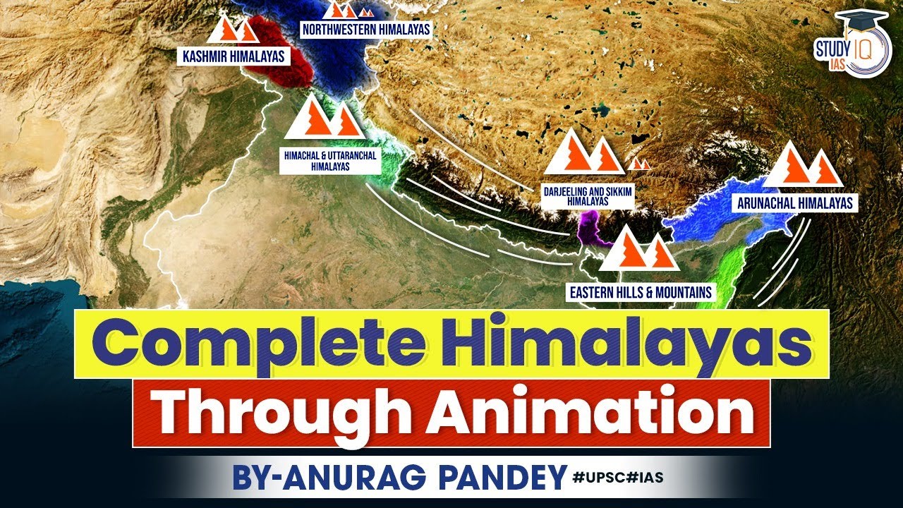
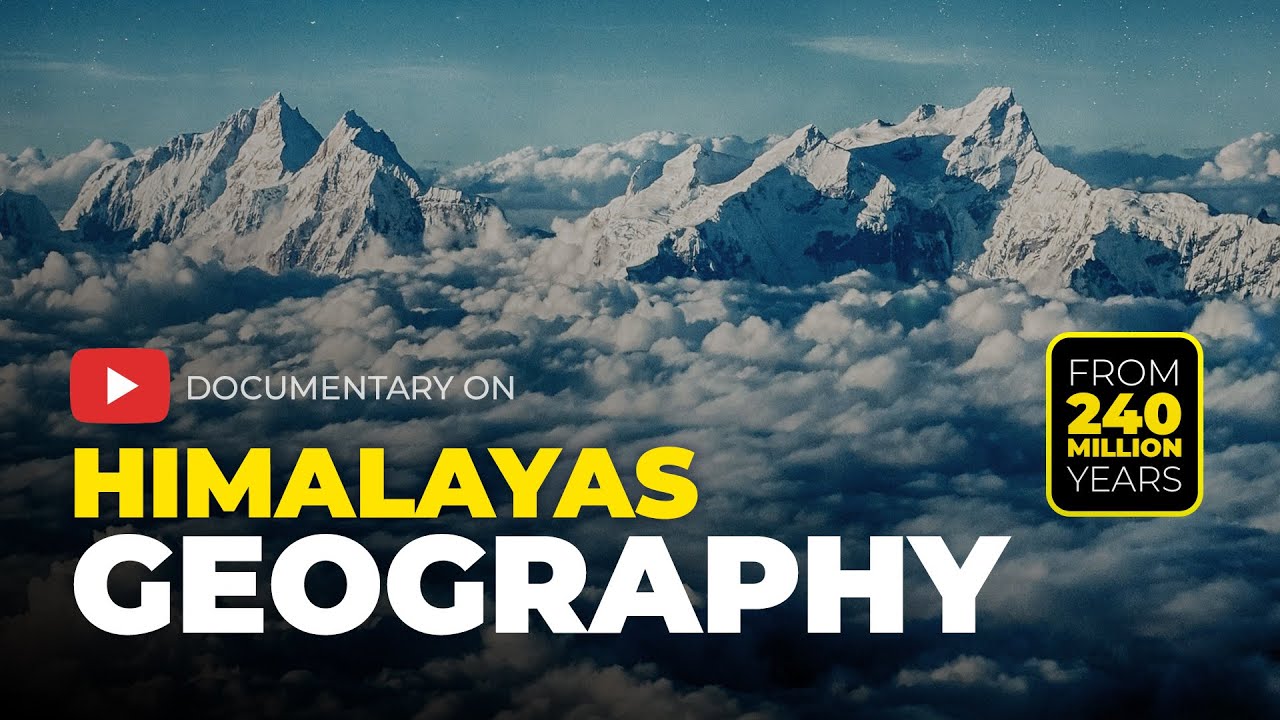
The Himalayan mountain system is not just one giant wall of rock. Instead, it is a beautiful collection of parallel mountain belts side by side, where each belt has its own special rocks, weather, and plant life. Learning about these physical layers helps us understand the landforms of the Indian subcontinent, how weather works, and where different animals and plants live. This topic is essential for every student preparing for competitive tests like UPSC and other geography examinations. Looking at these ranges helps us trace the step-by-step formation of these mountains, starting from the newest Shiwaliks all the way to the very old Trans-Himalayas.
🎯 In this chapter, you will understand:
- How the mountain ranges run parallel from west to east across different age groups.
- The special features of the Shiwaliks, including long valleys called duns.
- Why the Lesser Himalayas are famous for peaceful hill stations and long mountain chains.
- The towering peaks of the Greater Himalayas and the cold northern Trans-Himalayas.
💡 Why this topic matters: It explains how India's giant mountain wall was formed step by step and how it controls our weather, rivers, and borders.
🧠 Core Idea: The Himalayas are built like a series of giant steps rising from south to north, starting from loose foothill sediments to massive, snow-covered granite peaks.
The Comprehensive Geographical Division of the Himalayas: Parallel Ranges, Formation, and Unique Ecology
The grand Himalayas, often lovingly called the "Abode of Snow," are systematically organized into four major belts that run right beside each other, along with eastern mountain extensions in the northeast. This neat division based on height and geological age makes it much easier to see how tectonic plates pushed the ground up over time, how mountains shape our climate, and where unique wild plants and animals live.
- (i) Splitting the mountains into these sections helps us study how deep earth movements (tectonic processes) created different weather zones and habitats.
- (ii) The mountain belts line up in age, starting from the youngest outer foothills (Shiwaliks) and going back to the oldest inner rock layers (Greater Himalayas and Trans-Himalayas).

1. The Shiwaliks or Outer Himalayas: The Youngest and Southernmost Range
The Shiwaliks are the outer foothills facing the flat plains of northern India. Because they are the newest part of the entire system, they are made up of loose sand, mud, and gravel dropped by ancient rivers.
Extent, Elevation, and Unique Topographical Features of the Shiwaliks
These hills form the front step of the mountain system, working like a cushion between the tall Lesser Himalayas and the low river plains of India. Because they are geologically young, rivers have easily cut through them and broken them up into many smaller hill chains.
- (i) Description and Location: Known as the Outer Himalayas, these are the youngest hills. They sit right between the vast flat Great Plains of India and the higher Lesser Himalayas.
- (ii) Elevation and Extent: Their height is quite low compared to the inner mountains, ranging between 600 and 1500 meters above sea level. They stretch across a long distance of about 2,400 km, all the way from the Potwar Plateau in Pakistan to the Brahmaputra valley in Assam.

Map showing the geographic spread of the Shiwalik Range - (iii) Topographical Structure: These hills have a very steep slope facing south toward the Indian plains, but a gentler slope facing north toward the inner mountains. They are formed by folded rocks where downward valley folds are called synclines and upward hill folds are called anticlines or antisynclines.
The width of the belt shrinks as you travel east, narrowing down from about 50 km in Himachal Pradesh to less than 15 km in Arunachal Pradesh.

Diagram showing anticline upward folds and syncline downward folds
Geological Composition, Duns Formations, Flora, and Regional Names
The main identity of the Shiwaliks comes from river deposits and flat-bottomed valleys created when ancient lakes dried up.
- (a) Geological Composition: The hills are mostly made of soft conglomerates—mixes of sand, stones, mud, and small pebbles brought down by rivers flowing from the higher inner mountains.
- (b) Duns Formation: Long ago, these river deposits blocked the path of flowing rivers, creating temporary lakes. When rivers eventually broke through, the lakes drained away and left behind flat, fertile longitudinal valleys known locally as duns or doons. The city of Dehra Dun in Uttarakhand is the most famous example.
- (a) Flora and Fauna: The eastern side receives heavy rainfall and is covered with thick green forests that support many wild animals. However, toward the dry west, forest cover thins out. On the southern slopes in Punjab and Himachal Pradesh, seasonal rain streams called Chos wash away topsoil and cut deep gullies into the land.
- (b) Regional Names: Local communities give the Shiwaliks different names along their path: they are called the Jammu Hills in Jammu; the Dafla, Miri, Abor, and Mishmi Hills in Arunachal Pradesh; the Dhang Range and Dundwa Range in Uttarakhand; and the Churia Ghat Hills in Nepal.
2. Lesser or Middle Himalayas (Himachal): The Home of Famous Hill Stations
The Lesser Himalayas, also called Himachal, form the middle mountain belt. This region features rugged ridges, pleasant summer weather, beautiful green valleys, and world-famous tourist towns.
Elevation, Topographical Contrast, and Significance for Tourism
Sitting right between the low outer Shiwaliks and the massive snow capped Greater Himalayas, this middle belt rises sharply in height and hosts many comfortable retreat spots.
- (i) Location and Elevation: Known as the Himachal or Lower Himalayas, this line of mountains runs alongside the outer and inner ranges. Heights here generally range between 3,500 and 4,500 meters above sea level, with some high points going above 5,050 meters.
- (ii) Topographical Contrast: The southern slopes facing India are steep, bare, and rocky, making it hard for deep soil to stay put. In contrast, the northern slopes facing inward are gentler and covered with thick pine and oak forests.
- (iii) Significance and Resorts: People love this region for its cool, comfortable summer weather. It is home to famous hill towns like Shimla, Mussoorie, Ranikhet, and Darjeeling.
Major Ranges within the Lesser Himalayas: Pir Panjal and Dhaola Dhar
The Lesser Himalayas consist of several distinct, long mountain chains running across different northern states.
- (a) Pir Panjal Range: This is the longest and most famous mountain chain in the middle belt, stretching over 300 km in Kashmir between the Jhelum River and the Beas River. It features critical mountain cuts called passes, including the Pir Panjal Pass, Bidil, Golabghar Pass, and Banihal Pass, which allow roadways to cross through tall rock walls.

Outline map showing the path of the Pir Panjal Range in Kashmir - (b) Dhaola Dhar Range: Situated south of the Pir Panjal, this impressive, snow-dusted range lies almost entirely inside the state of Himachal Pradesh.
- (c) Other Ranges: Further east, this middle belt continues as the Mussoorie Range, extends into southern Nepal as the Mahabharat Lekh, and includes the high ridge known as the Nag Tibba Range.
- (a) Pir Panjal Range: This is the longest and most famous mountain chain in the middle belt, stretching over 300 km in Kashmir between the Jhelum River and the Beas River. It features critical mountain cuts called passes, including the Pir Panjal Pass, Bidil, Golabghar Pass, and Banihal Pass, which allow roadways to cross through tall rock walls.
3. The Greater Himalayas (Himadri): The Core of the Highest Peaks
The Greater Himalayas, also called the Inner Himalayas or Himadri, form the central spine of the mountain system. This range is the highest, most unbroken wall of rock and ice on Earth, holding giant rivers of frozen ice (glaciers).
Geology, Topography, and Hosting the World's Tallest Peaks
This central belt is made of ancient, hard rocks that have been squeezed upward into towering, ice-covered summits known all over the world.
- (i) Core Structure and Elevation: This is the backbone of the system, with a huge average height of 6,100 meters above sea level and a relatively thin width of roughly 25 km across.
- (ii) Geology and Folds: The core is made of strong crystalline metamorphic rocks like granite and gneiss, covered by altered layers of sedimentary rocks like limestone. The mountain folds are unsymmetrical, creating steep drops on the southern Indian side and gentle slants on the northern side, a shape geographers call hogback topography.
- (iii) Global Significance: The Himadri holds the highest mountain tops on Earth, including Mount Everest (called Sagarmatha in Nepal and Chomlungma in Tibet/China), which reaches up to a massive height of 8,848 meters.
Important Passes and Connectivity across the Greater Himalayas
Even though this wall of ice and rock is extremely tall, natural openings called passes allow people, traders, and travelers to cross over into Tibet.
- (i) Burzil Pass: Located in Jammu and Kashmir, serving as a high mountain crossing route.
- (ii) Zoji La: A vital high-altitude pass linking the valley of Srinagar to Ladakh.
- (iii) Bara Lacha La: Connects the green hills of Himachal Pradesh to Leh.
- (iv) Lipu Lekh: A historic trading pass linking the Kumaon region to Tibet.
- (v) Nathu La: A famous border trading point connecting Sikkim to Tibet in China.
4. The Trans-Himalayas – Tibetan Himalayas: The Northernmost Ranges
The Trans-Himalayas sit directly behind and north of the Great Himalayas, mostly inside Tibet. This region is a cold, dry, and wind-swept high desert filled with rugged mountain chains.
Major Ranges, Elevation, and Geographical Features
This high northern terrain contains some of the longest glaciers and highest wild peaks away from the Arctic and Antarctic poles.
- (i) Key Ranges Included: This outer belt consists of four primary mountain chains: the Zaskar, Ladakh, Kailas, and Karakoram ranges.
- (ii) Elevation and Extent: Sitting at an average height of 3,000 meters above sea level, these ranges stretch across a long distance of about 1,000 km from west to east.
- (iii) World Significance: Because it sits so far north and high up, it holds massive ice fields and giant glaciers, creating a cold alpine desert landscape.
Notable Peaks and the Source of Major Rivers
The Trans-Himalayas hold world-renowned giant summits like K2 and serve as the starting point (headwaters) for major Asian rivers.
- (a) Zaskar Range: Contains towering, icy mountains including Nanga Parbat (rising to 8,126 meters).
- (b) Kailas Range: Home to the sacred, pyramid-shaped peak of Mount Kailas (6,714 meters), where key river systems like the River Indus begin their long journey.
- (c) Karakoram Range: Running for 800 km, this mountain giant holds K2 (Mount Godwin Austen) at 8,611 meters, which is the second-tallest peak on the entire planet.
5. The Eastern Hills or Purvanchal: The North-Eastern Mountain Extension
The Eastern Hills, collectively called Purvanchal, are the southward turn of the Himalayan system running along India's northeastern border next to Myanmar.
Topography, Role as Watershed, and Major Regional Ranges
These lower, forest-covered hills curve downward like a bow, acting as a natural divider between river basins.
- (i) Topography and Elevation: Heights here are much lower compared to the northern giants, ranging from under 1,500 meters in the south (Mizo Hills) up to 3,826 meters in the north (Naga Hills).

Map showing the Purvanchal Hills along the northeastern border - (ii) Significance: The Purvanchal acts as a natural line separating the river systems of India and Myanmar (watershed). Because it receives heavy monsoon rains, it is packed with dense rainforests and rich wildlife.
- (iii) Major Ranges: Local names distinguish the various hill sections: the Patkai Bum Hills made of strong sandstone; the Naga Hills holding the peak Saramati; the Barail Range; and the Mizo Hills featuring Blue Mountain. Nearby, the Garo, Khasi, and Jaintia Hills are geologically part of the old Indian peninsular plateau, though closely linked to this eastern zone.
- (i) Topography and Elevation: Heights here are much lower compared to the northern giants, ranging from under 1,500 meters in the south (Mizo Hills) up to 3,826 meters in the north (Naga Hills).
⚡ Quick Revision Capsule: Himalayan Geographical Divisions
A quick comparison of the five main Himalayan belts showing their heights, rock types, and iconic geographic features:
| Himalayan Division | Average Elevation | Key Geological & Topographical Features |
|---|---|---|
| Outer Himalayas (Shiwaliks) | 600 to 1,500 meters | Youngest range, loose river mud/gravel deposits, flat valleys called duns (e.g., Dehradun). |
| Lesser Himalayas (Himachal) | 3,500 to 4,500 meters | Home to hill stations (Shimla, Mussoorie), Pir Panjal range, and Dhaola Dhar range. |
| Greater Himalayas (Himadri) | 6,100 meters (Average) | Core granite rock spine, tallest summits like Mount Everest, passes like Zoji La and Nathu La. |
| Trans-Himalayas (Tibetan) | 3,000 meters (Average) | Cold alpine climate, holds Karakoram Range, second-highest global peak K2, and Mount Kailas. |
| Eastern Hills (Purvanchal) | 1,500 to 3,826 meters | Dense rainforests, acts as a border watershed with Myanmar, includes Patkai, Naga, and Mizo hills. |
📝 Summary
The step-by-step division of the Himalayan mountain system into the Shiwaliks, Lesser Himalayas, Greater Himalayas, Trans-Himalayas, and Purvanchal offers a clear picture of India's land features. Understanding the special traits, heights, and rock layers of each belt is essential for mastering physical geography. Learning about duns, mountain passes, and local hill names helps students prepare thoroughly for competitive examinations while showing how India's land and monsoon weather are deeply connected.
🚀 Quick Revision Points
Essential facts to review before examinations:
- (i) The Himalayas run in four major parallel bands from south to north, rising from low sediment hills to massive granite crests.
- (ii) Long flat valleys between the Shiwaliks and Lesser Himalayas are called duns.
- (iii) The Pir Panjal is the longest mountain chain in the middle Lesser Himalayas belt.
- (iv) Mount Everest (8,848m) sits in the central Himadri axis, whereas K2 (8,611m) stands in the northern Karakoram Trans-Himalayan belt.
- 💡 Exam Tip: Always remember the exact south-to-north order: Shiwaliks → Lesser Himalayas → Greater Himalayas → Trans-Himalayas. Don't confuse K2 (Karakoram / Trans-Himalayas) with Mount Everest (Greater Himalayas / Himadri)!
❓ Frequently Asked Questions (FAQ)
Q1: What are 'Duns' and how were they formed in the Shiwaliks?
A1: Duns are flat longitudinal valleys created when ancient river-deposited mud blocked flowing rivers to form temporary lakes. When those lakes drained, flat fertile land remained, like Dehra Dun.Q2: Which mountain range in the Himalayas holds the famous hill stations?
A2: The Lesser Himalayas or Himachal range hosts popular tourist hill towns like Shimla, Mussoorie, Ranikhet, and Darjeeling due to its pleasant summer climate.Q3: What is the main difference between Mount Everest and K2 in terms of their mountain ranges?
A3: Mount Everest stands in the central core called the Greater Himalayas (Himadri), while K2 sits further north in the Karakoram Range of the Trans-Himalayas.