The Indo-Gangetic-Brahmaputra Plain is a massive, super-flat stretch of land in northern India. It was built over millions of years as giant rivers carried soil, sand, and small rocks down from high mountains. Imagine a huge natural bowl stretching across northern India that slowly got filled to the brim with smooth, fertile soil brought by running river water!
🎯 In this chapter, you will understand:
- How the collision of gigantic land masses formed both the high Himalayas and this huge flat plain.
- The step-by-step physical breakdown of the land layers from north to south (Bhabhar, Terai, Bangar, and Khadar).
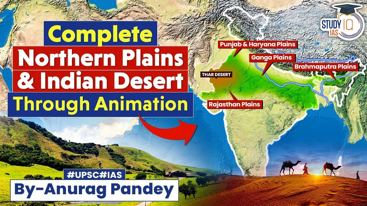
- The distinct geographic sections stretching across India, including the Rajasthan Plains, Punjab Plains, Gangetic Plains, and Brahmaputra Plains.
- Why this plain is so important for farming, feeding people, and supporting huge cities.
💡 Why this topic matters: This vast plain hosts about half of India's population and serves as the primary food source ("granary") of the country thanks to its deep, rich soil and continuous river water supply.
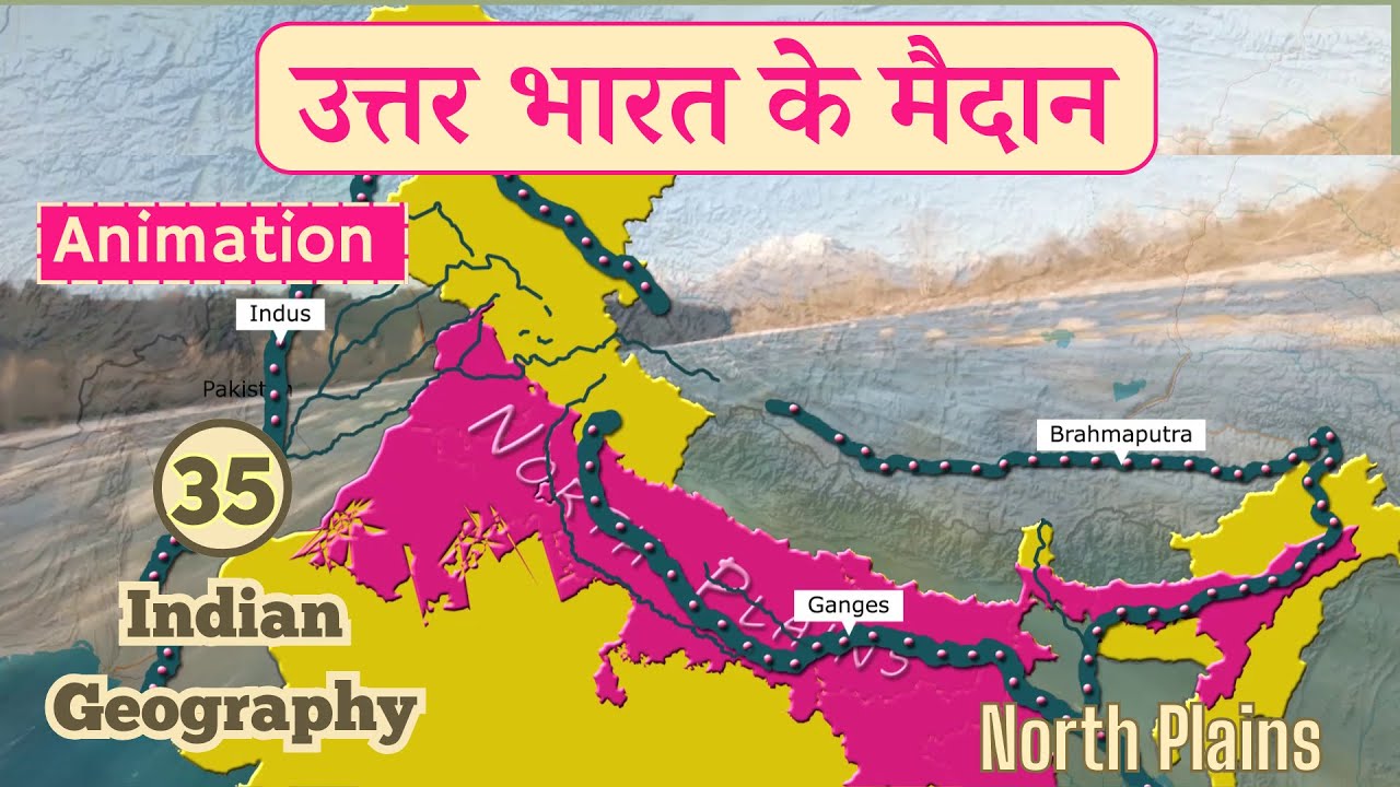
🧠 Core Idea: The northern plains were formed by an aggradational plain process—where deep ocean trenches and hollow depressions were continuously filled up with sediments carried by three major river systems: the Indus River, the Ganga River, and the Brahmaputra River.
📍 Boundaries and Slopes of the Great Plain
The plain is clearly separated from surrounding landforms by specific imaginary lines called contour lines, which measure height above sea level:
Geographical Limits and Flatness
The upper northern edge is marked by a contour line that separates the high Himalayas from the flat Gangetic Basin.
- (i) The southern edge touches the older peninsular plateau, marked by a contour line along most of its length.
- (ii) In the far northeastern corner near the river delta, this southern line drops down to a contour.
Slope Characteristics
The ground here is extremely flat and monotonous, meaning it looks almost the same for miles without high hills or deep valleys.
- (a) The land slopes down very gently at a tiny ratio between 1:1000 and 1:2000.
- (b) This soft tilt means that for every 1,000 to 2,000 meters you walk forward, the ground drops by only 1 meter!
🌋 Formation of the Indo-Gangetic-Brahmaputra Plain
The birth of these plains is directly connected to the creation of the giant Himalayan mountain range millions of years ago.

- Long ago, before the mountains existed, rivers flowed into an ancient body of water called the Tethys Sea.
Role of the Himalayas and Tethys Sea
When the giant tectonic land mass called the Indian Plate pushed northward and crashed into the Eurasian Plate, incredible pressure was created.
- (i) Layers of mud, sand, and rock sitting in the seabed (called the Tethys Geosyncline) were squeezed, folded, and pushed high up into the sky to form the giant Himalayas.
- (ii) As those mountains rose up, a massive deep basin or trough (hollow gap) opened up directly south of them.
River Actions and Sediment Filling
As the mountains kept rising, existing rivers cut deep paths into the rocks and entered a continuous young, powerful stage.
- (i) In their early stages, fast-flowing rivers cut downward into soft rock layers (vertical downcutting) and scraped mountain sides (headward erosion).
- (ii) Later on, they spread sideways (lateral erosion), dumping massive heaps of broken rocks, gravel, sand, and fine soil particles (alluvium and conglomerates) into the deep hollow gap between Peninsular India and the rising mountains.
- (iii) Over time, melting glaciers and new rivers supplied even more silt and mud. This continuous dumping filled the deep hollow gap completely, forcing the ancient Tethys Sea to retreat and leaving behind a smooth, curved (arcuate) plain.
- (iv) While smaller peninsular rivers helped a bit from the south, three master river networks did most of the work: the Indus River, the Ganga River, and the Brahmaputra River.
🧱 Regional Divisions from North to South
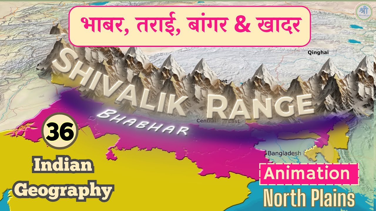
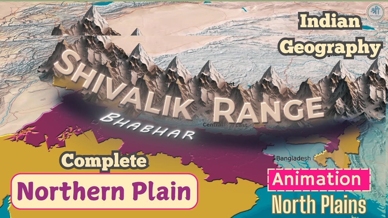
If you travel from the foot of the northern mountains down toward the river channels, you will cross four distinct zones of ground material: Bhabhar, Terai, Bangar, and Khadar.

Bhabhar and Terai Regions
These two upper belts lie closest to the base of the mountains.
The Bhabhar Belt
Located right next to the Shiwalik foothills, stretching continuously from the Indus River to the Tista River in a narrow strip about wide.
- (a) Made of coarse materials like heavy rounded stones (cobbles and pebbles), gravel, large rocks (boulders), and coarse sand.
- (b) Because there are big gaps between these loose rocks, water sinks right through (high porosity). Entire mountain streams disappear underground here during dry months!
- (c) This dry, rocky strip is bad for growing regular farm crops; only large trees with deep, long roots can survive here.
The Terai Belt
Located just south of the Bhabhar zone, running parallel to it from Punjab all the way to Assam in a wider band of .
- (a) The streams that sank into the Bhabhar rocks re-emerge at the surface here, creating a wet, swampy, marshy, and heavily forested area.
- (b) It is much wider and wetter in the eastern part of India because that region gets heavier rainfall.
- (c) The soil is packed with decayed plant matter (humus) and rich in nitrogen, making it super fertile for farming crops like sugarcane, rice, and wheat once cleared (especially in eastern Uttar Pradesh and Bihar).
Bangar and Khadar Regions
These two belts make up the main body of the plain further south.

Pictorial representation of erosion & deposition of Indo-Gangetic & Brahmaputra Plains - The Bangar Belt (Older Soil): Made of older river mud (alluvium) sitting on raised terraces higher up than regular flood levels. It contains hard calcium lumps called Kankar (calcareous concretions). Regional variations include the undulating Barind Plains in Bengal (dating back to the ancient Pleistocene era between the Mahananda River and Karatoya River) and wind-blown sand mounds called Bhur formations in the land between the Ganga and Yamuna rivers (Ganga-Yamuna Doab). It even holds buried fossils of ancient animals like rhinoceroses, hippopotamuses, and elephants! However, over-watered spots in Uttar Pradesh can get salty, forming barren soil called Usar lands.
- The Khadar Belt (Newer Soil): Made of fresh, soft mud (newer alluvium) deposited along river banks every time the river overflows during annual floods. Because it gets a brand-new top layer almost every single year, it is one of the most fertile farming soils in the world along the Ganga River.
- Reh or Kollar (Saline Soil): Salty white crusts formed on dry soil in places like Haryana. When farmers flood fields with too much irrigation water, water gets drawn upward by tiny tubes in the dirt (capillary action), leaving behind harsh salty deposits on top.


⚡ Quick Revision Capsule: Comparing Bhabhar, Terai, Bangar, and Khadar
Use this summary table to quickly compare how these four main land belts differ from each other:
| Zone Name | Composition & Soil Type | Key Features & Uses |
|---|---|---|
| Bhabhar | Heavy pebbles, boulders, cobbles, and coarse sand. | Extremely porous strip ( wide); streams disappear underground; unsuitable for crops. |
| Terai | Fine marshy soil rich in nitrogen and organic humus. | Swampy belt ( wide); underground streams re-emerge; great for sugarcane, rice, and wheat. |
| Bangar | Older alluvium with calcium lumps (Kankar) and ancient fossils. | High river terraces above flood lines; includes sand-built Bhur mounds and Barind clay tracts. |
| Khadar | Freshly deposited river silt and fine newer alluvium. | Low-lying floodplains renewed almost every year by river floods; incredibly fertile for heavy crop farming. |
| Reh / Kollar | Saline efflorescence (salty crust on top soil). | Formed in dry regions like Haryana due to excessive irrigation water pulling subsoil salts up via capillary action. |


🗺️ Major Sub-Regions of the Plain
The vast plain stretches across thousands of kilometers and is divided into four major regional sections from west to east:
1. Rajasthan Plains
Located in western India, bordered by the Ghaghar River basin in the north and the ancient Aravalli Range in the east, sitting at an average height of above sea level. It forms part of the great Thar Desert.
- (i) Divided into two parts by an imaginary rainfall line called the isohyete (a line connecting places with equal rainfall).
- (ii) The drier western part is called Marusthali, covered in shifting sand dunes called Dhrian and hardy trees like the Khejri tree protected by the local Bishnoi tribe.
- (iii) The semi-arid eastern part is called Rajasthan Bagar, containing fertile patches called Rohi and large salty lakes like Sambhar Lake, Didwana, Degana, and Kuchaman.
2. Punjab Plains
Spanning roughly at an average elevation of , built by five famous tributaries of the Indus river system: the Jhelum River, Chenab River, Ravi River, Sutlej River, and Beas River.
- (i) These rivers create special land strips between two converging rivers called doabs, including the Chaj Doab, Rechna Doab, Bist Doab, Bari Doab, and Sindsagar Doab.
- (ii) The plain is bounded on the east by a contour line along the Delhi-Ambala ridge.
- (iii) It features sub-regions like the Malwa Plain (south of the Sutlej) and the Haryana Tract (between the Ghaghar and Yamuna rivers). The seasonal Ghaghar River is considered the modern-day remnant of the ancient mythical Saraswati River.
3. Gangetic Plains
This is the largest portion of the Great Plain, spanning about from Delhi all the way to Kolkata. Built by the mighty Ganga River and its tributaries, it features natural embankments (levees), steep riverbanks (bluffs), crescent-shaped lakes (oxbow lakes), wet marshes, and deep water-cut gully valleys (ravines).
- (i) Rivers here often switch their paths; for example, the wandering Kosi River is famously nicknamed the 'Sorrow of Bihar' because its sudden path changes cause terrible floods.
- (ii) Upper Gangetic Plain: Includes the Rohilkhand Plains, Ganga-Yamuna Doab, and the Yamuna-Chambal Basin.
- (iii) Middle Gangetic Plain: Includes the Awadh Plain, Mithila Plain, and Magadh Plain.
- (iv) Lower Gangetic Plain: Includes the Paradelta, Rarh Plains, and the vast coastal Delta Plains known as the Sunderbans.
4. Brahmaputra Plains
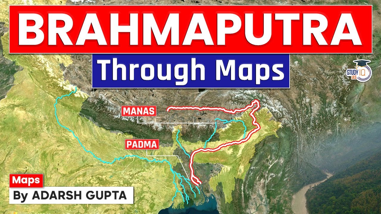
Also known as the Assam Valley or Assam Plains, this long, narrow belt is formed by sediment dropped by the heavy-flowing Brahmaputra River and its mountain streams.
- (i) It stretches from the western border of Indo-Bangladesh to the eastern mountain walls of the Purvanchal Hills.
- (ii) It features fan-shaped sediment heaps (alluvial fans), winding river curves (river meandering), cut-off curved lakes (oxbow lakes), wide swampy areas, and semi-wet terrain conditions (semi-terai) caused by heavy gravel dropped by swift mountain streams.
📝 Summary
The Indo-Gangetic-Brahmaputra Plain is one of the largest continuous alluvial stretches in the world. Formed over millions of years alongside the uplift of the Himalayas, it converted a deep sea trough into a super-flat agricultural wonderland. Housing half of India's population, its rich soils, perpetual river water, and flat ground make it the ultimate backbone for Indian farming, rail/road transportation, industrial cities, and cultural history along sacred rivers like the Ganga and Yamuna.
🚀 Quick Revision Points
Essential facts to review before examinations:
- (i) Boundaries: Defined by the elevation contour in the north and / contours in the south, with a very gentle slope of 1:1000 to 1:2000.
- (ii) Creation Mechanism: Mountain erosion washed sediment down into a deep trough created during the collision of the Indian Plate and Eurasian Plate.
- (iii) Four Soil Belts (North to South):Bhabhar (porous gravel/rocks) ➔ Terai (wet swampy forest) ➔ Bangar (older raised alluvium with Kankar) ➔ Khadar (fresh annual flood alluvium).
- (iv) Key Local Features:Dhrian (shifting sand dunes), Doabs (land between two rivers), Kosi River (nicknamed 'Sorrow of Bihar'), and Reh/Kollar (salty surface crust from capillary action).
- 💡 Exam Tip: Always remember the geographical ordering of the four belts from North to South: Bhabhar ➔ Terai ➔ Bangar ➔ Khadar. Remember that streams disappear in the porous Bhabhar rocks and re-emerge in the swampy Terai belt!
❓ Frequently Asked Questions (FAQ)
Q1: Why do rivers disappear in the Bhabhar region?
A1: The Bhabhar belt is made of large, loose rocks like boulders, cobbles, and pebbles. Because these rocks leave big open spaces between them, the soil has high porosity, allowing water to sink completely underground.Q2: What is the main difference between Bangar and Khadar soil?
A2: Bangar represents older alluvium that sits on higher terraces above annual flood levels and contains hard calcium lumps called Kankar. Khadar consists of fresh, newer alluvium deposited on low floodplains by rivers almost every year, making it far more fertile.Q3: What causes Reh or Kollar in dry farming areas?
A3: In dry places like Haryana, heavy field irrigation combined with high heat causes water to evaporate quickly. Water from deep underground gets pulled up to the surface through tiny soil spaces by a process called capillary action, leaving behind crusty white salt deposits known as Reh or Kollar.