The Indian Peninsular Plateau (often referred to broadly alongside the Deccan Plateau) represents one of the most ancient landmasses on Earth, taking shape as far back as the . This vast region is rich in mineral wealth, shaped by ancient river drainage systems, and made up of sturdy geological formations like gneiss and schist.
🎯 In this chapter, you will understand:
- The fundamental geographical definition and structural traits of a plateau.
- The key physical dimensions, age, stability, and river drainage patterns of the Peninsular Plateau.
- The specific characteristics of minor plateaus including Marwar, Central Highland, Bundelkhand, and Malwa.
- How tectonic forces and river erosion have sculpted unique landscapes like rift valleys and badlands.
💡 Why this topic matters: The Peninsular Plateau forms the geological backbone of southern and central India, defining its river directions, agricultural soils, and landscape variety.
🧠 Core Idea: A plateau is a high landform with a flat top. India's Peninsular Plateau is a giant, extremely old, triangular land block made of smaller plateaus, hills, and river valleys.
Definition of Plateau
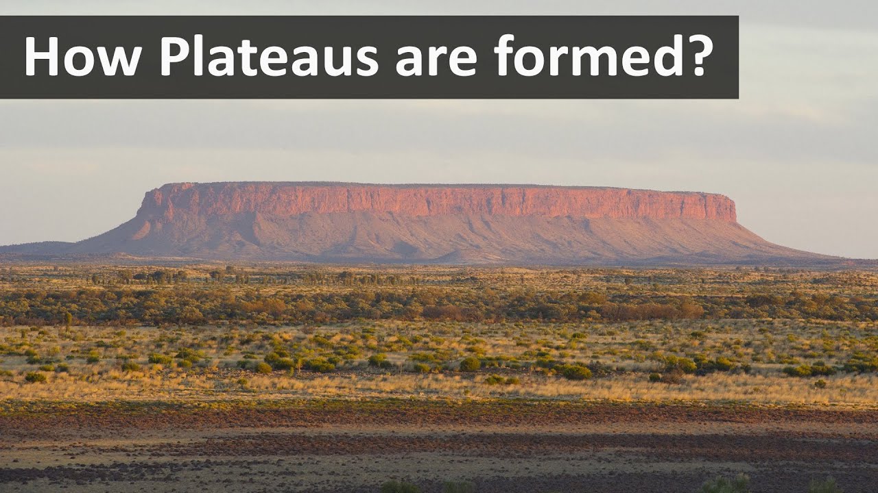
A plateau is a large area of land that sits much higher than the ground around it on at least one side, but remains mostly flat on top, like a giant table.
Understanding Plateau Landforms
These elevated flatlands have unique natural features that separate them from regular hills or mountains.
- (i) A plateau is defined as a landform that rises sharply above the surrounding area on at least one side, characterized by a flat top.
- (ii) Plateaus are typically isolated, standing alone without surrounding plateaus.
National Geographic Definition
According to National Geographic, plateaus are flat and elevated landforms that can significantly differ in height from the surrounding terrain.
Features of the Peninsular Plateau
The Peninsular Plateau forms the massive central and southern core of India's physical geography.

- The Peninsular Plateau is roughly triangular in shape, with its base coinciding with the southern edge of the great plain of North India. The apex of this triangular plateau is at .
- It covers a vast area of approximately 16 lakh square kilometers, while the total area of India is about 32 lakh square kilometers. This makes the plateau a significant portion of the Indian landmass.
- The average height of the Peninsular Plateau ranges between 600 to 900 meters above sea level, though this height varies across different regions within the plateau.
- The majority of the rivers originating from the Peninsular Plateau flow from west to east, reflecting the general slope of the land.
- An exception to this west-to-east flow is the Narmada and Tapti rivers, which flow from east to west in a rift valley caused by divergent tectonic plates.
- The Peninsular Plateau is one of the oldest landforms on Earth, formed during the .
- It is a stable block primarily composed of ancient Archaean gneisses and schists, indicating long-term geological stability.
- For several hundred million years, the Peninsular Plateau has remained a land area with minimal submersion beneath the sea.
- The plateau is an aggregation of several smaller plateaus, hill ranges, river basins, and valleys, creating a diverse landscape.
Minor Plateaus in the Peninsular Plateau
The massive Peninsular Plateau is made up of several smaller plateau regions, each with its own rocks, soil, and river networks.
- (i) Marwar Plateau or Mewar Plateau:
- Location: Eastern Rajasthan, east of the Aravalis.
- Average elevation: 250-500 meters above sea level, sloping eastwards.
- Composition: Sandstone, shales, and limestones from the .
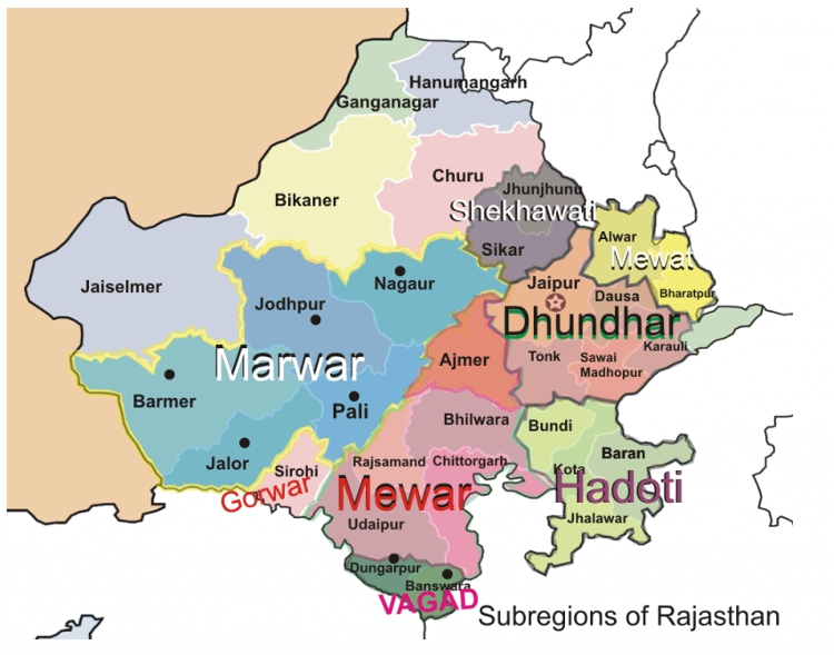
Images of marwar plateau in central India - Rivers: The Banas River and its tributaries (Berach, Khari) originate in the Aravalis and flow northwest into the Chambal River. Erosional activity creates a rolling plain appearance.
- Rolling Plain: Slight rises and falls in the landform, similar to the prairies of the USA.
- (ii) Central Highland:
- Also called the Madhya Bharat Pathar or Madhya Bharat Plateau.
- Location: East of the Marwar or Mewar Upland.
- Composition: Basin of the Chambal River, flowing through a rift valley.
- Main tributaries: Kali Sindh, Banas, Parwan, and Parbati rivers.
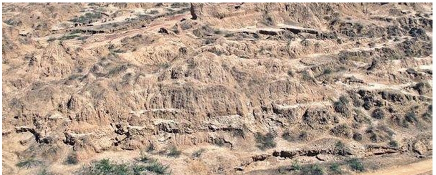
Images of ravines or badlands - Characteristics: Rolling plateau with rounded hills made of sandstone and thick forests. The northern region features Chambal river ravines or badlands.
- (iii) Bundelkhand Upland:
- Location: Bordered by Yamuna river (north), Madhya Bharat Pathar (west), Vindhyan Scarplands (east and southeast), and Malwa Plateau (south).
- Composition: Dissected upland of 'Bundelkhand gneiss' made of granite and gneiss.
- Extent: Covers five districts in Uttar Pradesh and four districts in Madhya Pradesh.
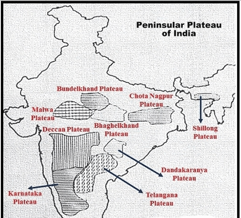
Images of bundelkhand plateau - Elevation: 300-600 meters above sea level, sloping from Vindhyan Scarp to Yamuna River.
- Features: Chain of hillocks made of granite and sandstone. The region has an undulating surface due to erosional work by rivers, rendering it less suitable for cultivation.
- Characterized by senile topography, streams include Betwa, Dhasan, and Ken.
- (iv) Malwa Plateau:
- Shape: Roughly triangular, based on the Vindhyan Hills, bounded by the Aravali Range (west), Madhya Bharat Pathar (north), and Bundelkhand (east).
- Drainage systems: One towards the Arabian Sea (Narmada, Tapi, Mahi), and another towards the Bay of Bengal (Chambal, Betwa, joining Yamuna).
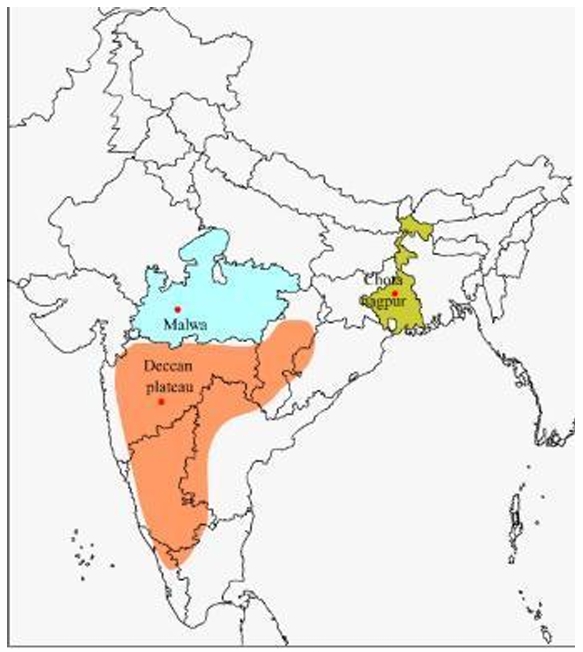
Images of Malwa Plateau in central India - Drainage in the north: Chambal River and its right-bank tributaries (Kali, Sindh, Parbati). Includes upper courses of Sindh, Ken, and Betwa rivers.
- Composition: Extensive lava flow covered with black soils.
- Slope: General slope towards the north, decreasing from 600 meters in the south to less than 500 meters in the north.
- Characteristics: Rolling plateau dissected by rivers; Chambal ravines mark the northern part.
- (i) Marwar Plateau or Mewar Plateau:
⚡ Quick Revision Capsule: Peninsular Plateau Core Features
A quick comparison of key definitions and geological traits of India's Peninsular Plateau.
| Feature Category | Geographical Description | Key Details & Significance |
|---|---|---|
| Definition of Plateau | Plateau is an area of raised land that is flat on top. | Plateaus are often isolated with no surrounding plateaus. National Geographic describes plateaus as flat and elevated landforms that rise sharply above the surrounding area on at least one side. |
| Features of the Peninsular Plateau | Roughly triangular in shape with its base coinciding with the southern edge of the great plain of North India. The apex is at . | Covers a total area of about 16 lakh sq km (India as a whole is 32 lakh sq km). Average height: 600-900 m above sea level (varies by region). Most rivers flow west to east, indicating a general slope. |
| Drainage & Stability | Exception: Narmada-Tapti rivers flow east to west in a rift valley caused by a divergent boundary. | One of the oldest landforms on earth, composed of Archaean gneisses and schists. Stable block with little structural change since its formation. A land area for millions of years, submerged in the sea only in a few places. An aggregation of several smaller plateaus, hill ranges, river basins, and valleys. |
📝 Summary
The Peninsular Plateau of India is an exceptionally old geological feature dating back to the . Covering nearly half of India's entire area (16 lakh sq km), this stable land block stands at an average elevation of 600 to 900 meters. While most rivers tilt eastward toward the Bay of Bengal, the Narmada and Tapti flow westward in rift valleys. The region features distinctive sub-regions such as the Marwar, Central Highland, Bundelkhand, and Malwa plateaus, marked by ancient rock types, rolling plains, black lava soils, and deep river ravines.
🚀 Quick Revision Points
Essential facts to review before examinations:
- (i) Plateau: An elevated flatland rising sharply on at least one side above surrounding land.
- (ii) Triangular Shape: Base along North Indian plains, apex reaching south to .
- (iii) Archaean Rocks: Composed mainly of ancient gneisses and schists.
- (iv) Distinct Sub-regions: Includes Marwar rolling plains, Central Highland badlands, Bundelkhand senile topography, and Malwa's black soil lava plateau.
- 💡 Exam Tip: Remember that while most peninsular rivers flow from west to east following the land's slope, the Narmada and Tapti are crucial exceptions that flow east to west because they run through fault-formed rift valleys!
❓ Frequently Asked Questions (FAQ)
Q1: What is a plateau in simple terms?
A1: A plateau is a high landform that has a broad, flat top—like a table standing high above the flatter land around it.Q2: Why do the Narmada and Tapti rivers flow west instead of east?
A2: Unlike other peninsular rivers that follow the general eastward tilt of the land, Narmada and Tapti flow westward because they run inside rift valleys formed by tectonic plate forces.Q3: What kind of rock and soil dominate the Malwa Plateau?
A3: The Malwa Plateau was formed by old lava flows, giving it thick, fertile black soils resting over ancient rock structures.