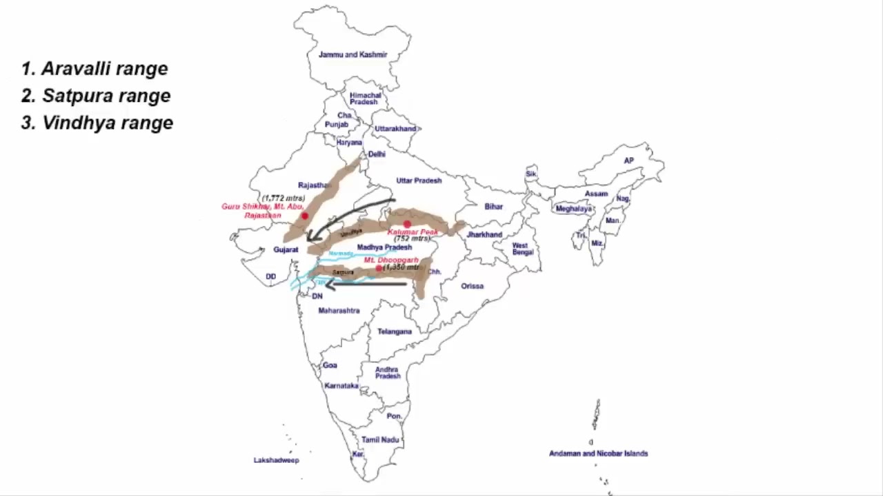
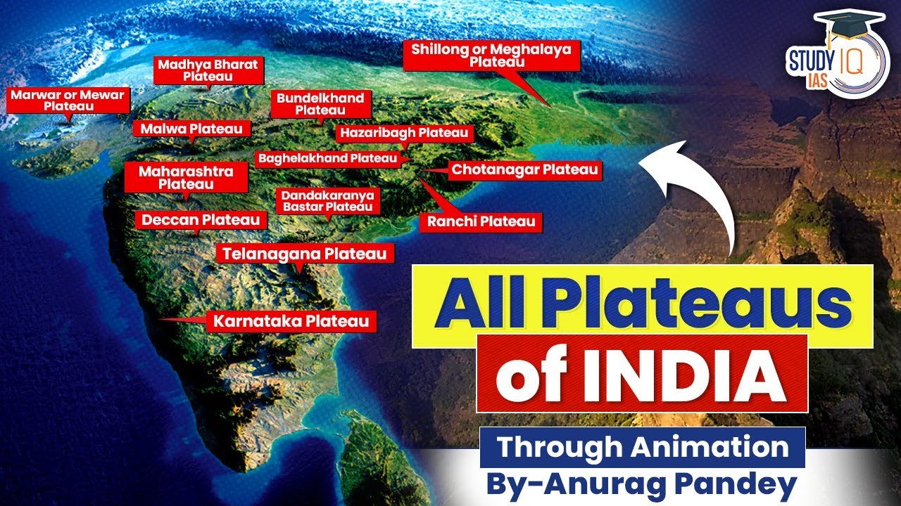
The southern part of India sits on a very old and solid piece of land called the Peninsular Plateau. Millions of years ago, natural forces shaped this giant landmass into bumpy tablelands, rolling hills, and deep river valleys. In this guide, we will explore its major sections, starting from the northeastern corner down to the massive central and southern plateaus.
🎯 In this chapter, you will understand:
- How the Chotanagpur Plateau and Meghalaya Plateau were formed and separated over time.
- The physical makeup of the giant Deccan Plateau and its regional parts.
- The features of eastern regions like Telangana, Bastar, and the Chhattisgarh Plain.
- Why these ancient rocks hold almost all of India's valuable coal and metal minerals.
💡 Why this topic matters: This land contains India's largest mineral storehouses, major river origins, and unique landforms that shape our local climate, farming, and industry.
🧠 Core Idea: The Indian Peninsula is a elevated, ancient tableland split into sub-plateaus by deep river valleys and ancient tectonic movements.
The Chotanagpur Plateau & Northeastern Extensions
The Chotanagpur Plateau stands as the famous northeastern projection of the Indian Peninsula. It stretches across most of Jharkhand, northern Chhattisgarh, and the Purulia district of West Bengal. The land features an intricate network of many rivers that flow outwards in all directions, creating a classic radial drainage pattern (like spokes on a bicycle wheel).
The Rajmahal Hills & Meghalaya Plateau
Important rivers like the Damodar, Subarnarekha, North Koel, South Koel, and Barakar flow across this highland. The Damodar River cuts right through a deep rift valley that holds India's primary Gondwana coal fields. Over millions of years, water erosion has broken this landscape into smaller parts like the Hazaribagh Plateau and the Ranchi Plateau.
- (i) Sitting on its northeastern corner are the Rajmahal Hills, a mountain range running north-to-south made almost entirely of black volcanic basalt rock.
- (ii) Farther east past the Rajmahal Hills lies the Meghalaya Plateau, which is actually a detached piece of the main peninsular block.
The Garo-Rajmahal Gap
A huge structural sinking of the earth's crust created a deep trench called the Garo-Rajmahal Gap. This physical gap separated the Meghalaya Plateau from the main peninsula. Over long periods of time, mud and soil deposited by the Ganga and Brahmaputra rivers filled up this low gap.
- (a) The western border of this plateau lines up with the international border of Bangladesh.
- (b) It features famous hill ranges including the Garo Hills (rising to 900 metres).
- (c) The Khasi-Jaintia Hills reach an elevation of 1,500 metres, while the Mikir Hills stand at 700 metres.
- (d) The highest point of this entire region is Shillong Peak, reaching up to 1,961 metres.
The Great Deccan Plateau & Regional Divisions
Covering a vast area of 5 lakh square kilometres, the giant Deccan Plateau dominates the southern portion of the Indian Peninsula. Bordering its northern end are the Satpura, Vindhya, Mahadev, and Maikal mountain ranges, while its western and eastern edges are bordered by the Western Ghats and Eastern Ghats.

- The plateau gently slopes from west to east, which is clearly shown by the natural flow of its major rivers. These river paths divide the big landmass into smaller regional plateaus.
Maharashtra & Karnataka Plateaus
The northern layer of this system is the Maharashtra Plateau, which rests on top of thick layers of ancient volcanic basaltic rock. Natural weathering over time has turned this area into a gently rolling plain where rivers like the Godavari, Bhima, and Krishna flow through wide, shallow valleys.
- (i) Located right below the basaltic northern area is the Karnataka Plateau, also traditionally known as the Mysore Plateau.
- (ii) It sits at an average height of 600 to 900 metres and is cut into pieces by fast rivers coming out of the Western Ghats.
- (iii) The region splits naturally into two physical zones: the Malnad, a hilly and forested western zone, and the Maidan, an open, rolling plain on the eastern side.
- (iv) This elevation creates a cooler climate and unique drainage paths across southern India.
Telangana, Bastar, and Central Plains
Further east lies the Telangana Plateau, a land made of very old rock formations like Archaean gneisses, Dharwar metamorphic rocks, and underground Gondwana coal layers. Resting at an average height of 500 to 600 metres, it is watered by three main river systems: the Godavari, Krishna, and Penner.
- Moving towards central India, we find the Bastar Plateau located in southern Chhattisgarh. It is an extremely mineral-rich highland divided into two halves by the Indravati River, widely recognized as a dense forest region inhabited by native tribal groups that has historically seen significant Naxalite activity.
Chhattisgarh Plain & Dandakaranya Plateau
Just north of Bastar sits the Chhattisgarh Plain, a special low-lying region shaped like a giant saucer and drained completely by the upper waters of the Mahanadi River system.
The saucer-shaped basin of the Chhattisgarh Plain drained by the Mahanadi River. - Plain Elevation: The land gently rises from an elevation of 250 metres in the east up to 330 metres along its western edges.
- Historical Name: Historically governed by the Haithaivanshi Rajputs, the plain gets its name directly from the thirty-six (chhattis) historic forts built across the region.
- Dandakaranya Region: Surrounding the greater Bastar area and spreading beyond it is the Dandakaranya Plateau.
- Cultural Epic Significance: Mentioned in the ancient epic Ramayana, this broad geographic landscape stretches across parts of Chhattisgarh, Odisha, Telangana, and Andhra Pradesh, and houses the rugged Abujhmad Hills where native tribal families live.
⚡ Quick Revision Capsule: Indian Plateaus
Here is a quick comparison table outlining the key physical features, elevations, and main rock types found across the major plateaus of Peninsular India:
| Plateau Region | Average Elevation & Extent | Key Features & Rock Types |
|---|---|---|
| Chotanagpur Plateau | Variable hill heights; includes Ranchi and Hazaribagh units | Radial river drainage; contains rich Gondwana coal deposits. |
| Meghalaya Plateau | 900m to 1,961m (highest point at Shillong Peak) | Separated from peninsula by Garo-Rajmahal Gap; includes Garo, Khasi, and Jaintia Hills. |
| Deccan Plateau | Spans over 5 lakh square kilometres | Slopes westward to eastward; formed from volcanic basalt rock layers. |
| Karnataka Plateau | 600 to 900 metres elevation | Divided into two zones: rugged Malnad hills and open Maidan plains. |
| Chhattisgarh Plain | 250 to 330 metres elevation | Saucer-shaped river basin created by the Mahanadi River system; named after chhattis (36) forts. |
💡 Value-Add Geographic Insights
Below are extra insights highlighting the geological origins and tectonic events that shaped these unique landforms:
- The Gondwana & Dharwar Mineral Bedrocks: The Chotanagpur Plateau and Telangana Plateau serve as India's main mineral treasure boxes, but they formed in completely different ways. The Chotanagpur Plateau stores nearly 100% of India's high-grade metallurgical coal inside its unique Gondwana sedimentary rift basins. On the other hand, the Telangana and Karnataka plateaus are full of iron ore, manganese, and gold due to their ancient Dharwar rock formations.
- The Garo-Rajmahal Gap Tectonic Shift: The separation of the Meghalaya Plateau from the main peninsular landmass is a famous example of earth movement (plate tectonics). When the Indian tectonic plate crashed northward into Asia, immense tension caused the land between the Rajmahal Hills and the Shillong Plateau to drop down. This created a huge lowland depression that allowed the Ganga and Brahmaputra rivers to flow together, deposit rich river soils, and form the delta area of modern West Bengal and Bangladesh.
📝 Summary
The Peninsular Plateau forms the geological backbone of India. From the volcanic lava flows of the Deccan Plateau to the coal-rich rift valleys of the Chotanagpur Plateau and the isolated peaks of the Meghalaya Plateau, this vast highland shapes India's river systems, forests, and mineral wealth. Historical references like the ancient forest of Ramayana in the Dandakaranya Plateau further highlight the deeply intertwined geographical and cultural history of this region.
🚀 Quick Revision Points
Essential facts to review before examinations:
- (i) Chotanagpur Plateau exhibits a radial drainage pattern and houses major Gondwana coal fields.
- (ii) The Garo-Rajmahal Gap was created by tectonic faulting and filled by silt from the Ganga and Brahmaputra rivers.
- (iii) The Deccan Plateau is made largely of volcanic basalt and slopes towards the east.
- (iv) The Dandakaranya Plateau holds cultural importance in the ancient epic Ramayana.
- 💡 Exam Tip: Remember that the Malnad is the forested, mountainous western section of the Karnataka Plateau, whereas the Maidan is the flat, open eastern section!
❓ Frequently Asked Questions (FAQ)
Q1: Why is the Meghalaya Plateau separated from the main Indian Peninsula?
A1: It was physically separated when structural faulting caused the land to sink, forming the Garo-Rajmahal Gap, which was later filled with river soil.Q2: What is the main difference between the Malnad and the Maidan?
A2: Both are parts of the Karnataka Plateau; Malnad refers to the rugged, forested hills in the west, while Maidan refers to the rolling open plain in the east.Q3: How did the Chhattisgarh Plain get its name?
A3: It historically derives its name from the thirty-six (chhattis) historical forts scattered across the region during the rule of the Haithaivanshi Rajputs.