Learning about geomorphic agents is very important for students who are studying physical geography. It helps us understand how running water and underground water shape the land over . This guide explains the erosional and depositional landforms built by these natural forces, focusing on how river valleys grow and how unique Karst topography forms.
🎯 In this chapter, you will understand:
- How running water moves across land and wears it down over time.
- The three main life stages of a river system: youth, mature, and old age.
- Key features formed when water cuts into rock versus when it drops sediment.
- How underground water dissolves limestone to craft caves and unique surface shapes.
💡 Why this topic matters: Water is the most powerful land sculptor on Earth. Knowing how it forms river banks, valleys, and underground caves gives us a clear look into our planet's history and land changes.
🧠 Core Idea: Water wears away rock in some places through erosion and drops soil or sand in other places through deposition, constantly changing the shape of the land.
📌 Running Water as a Primary Geomorphic Agent and Landscape Evolution: Shaping Terrestrial Features Over Time
Flowing water acts as a strong primary geomorphic agent, especially in wet and rainy areas called humid regions. Rainwater continuously wears down the ground surface. Water sculpts the land in two main ways:
The two main ways water flows across the land include:
- (i) Overland flow, which is also known as sheet flow. Here, water moves over broad land as a thin, wide layer before gathering into smaller streams.
- (ii) Linear flow, which includes moving streams and rivers that flow within fixed, narrow paths called channels inside valleys.
- (iii) The angle of the slope determines how water acts: erosion happens mostly on steep slopes where water cuts into rock, while deposition takes place on gentler slopes where water slows down and drops sediments.
Overland Flow and the Genesis of Fluvial Erosion Features
When water flows freely across open land, it starts eroding the surface. Slowly, it turns smooth ground into hilly land cut by small channels and deep valleys.
The Progression from Sheet Erosion to Valley Networks
The first step in this process is sheet erosion. This happens when a thin sheet of water evenly washes away fine soil particles from the top layer of ground. Soon, water gathers into tiny pathways, speeding up erosion.
- (i) As more water flows faster, it cuts unevenly into the dirt, carving tiny, thin grooves called rills.
- (ii) These rills do not last long on their own. As more water rushes through, they dig deeper and wider, growing into much bigger trenches called gullies.
- (iii) Over time, these gullies spread out and join together to form a connected network of valleys. This network drains water across whole regions and removes temporary land features like waterfalls.
Stages of Landscape Development in Running Water Regimes: The River Life Cycle
A river landscape changes through distinct life stages over . Each stage creates its own unique land shapes through erosion and sediment drop.

Fluvial landforms, illustrating deltas and oxbow lakes formed by sediment deposition in river systems. The Youth Stage: V-shaped Valleys and High Energy
During the Youth Stage, a fast-moving river cuts straight down into the land. The surrounding landscape remains high and steep with incomplete drainage paths.
- (i) There are only a few stream channels. Valleys are shallow and shaped like a sharp V-shape, with no broad, flat river banks yet.
- (ii) High areas between streams, called stream divides, are broad and flat. They often hold poorly drained areas like swamps, marshes, and lakes.
- (iii) Fast water rushing over hard rock layers creates dramatic land features such as waterfalls and rapids.
The Mature Stage: Valley Deepening and Integrated Drainage
The Mature Stage brings balance. The river system gets better connected, and the stream begins cutting sideways into its banks instead of just digging straight down.
- (a) Many new tributary streams form and link together. Valleys keep their V-shape, but they grow much deeper than in the youth stage.
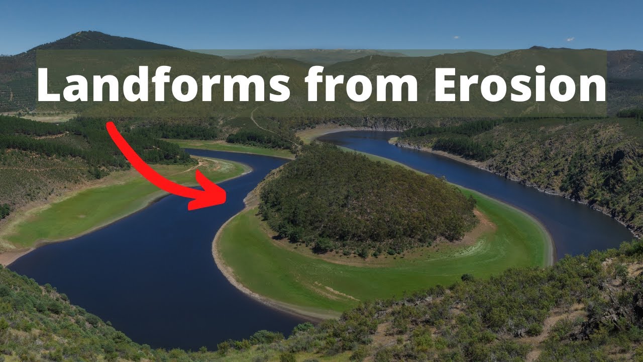
- (b) Flat areas beside the river, called floodplains, become wider. Rivers start to curve sideways, forming winding loops called meanders.
- (c) The rushing water wears down hard rock obstacles, causing old waterfalls and steep rapids to smooth out and disappear.

Fluvial landforms, showing V-shaped valleys, floodplains, and meanders formed by the erosional and depositional work of rivers. The Old Stage: Lateral Dominance and Peneplanation
In the Old Stage, the river flows very slowly near sea level. Sideways erosion and dropping sediment are the main activities, creating very flat land.
- (i) Smaller side streams have gentle slopes. The main river winds slowly across large distances in looping paths.
- (ii) Extremely vast floodplains stretch out around the river, showcasing features like raised mud banks called natural levees and curved oxbow lakes.
- (iii) Land between streams becomes flat and low, leaving a giant flat plain known as a peneplain that rests close to sea level.

Natural levee and point bars, showing features created by sediment deposition along riverbanks during flooding events.
Major Erosional Landforms Created by Running Water Systems
As rivers flow downhill, their fast energy and heavy sediment loads carve out remarkable shapes in rock and soil.
Valleys: The Signature of Fluvial Erosion (V-shaped, Gorge, and Canyon)
Valleys are the most common land features cut by streams. They start as tiny rainwater rills, deepen into gullies, and eventually expand into huge valley networks over thousands of years.
- (i) V-shaped valleys, gorges, and canyons are the three primary types of river valleys.
- (ii) A Gorge is a very narrow, deep valley with nearly straight and steep rock walls. It forms when a river cuts down through hard, tough rock.
- (iii) A Canyon has steep sides shaped like step stairs. It is noticeably wider at the top than at the bottom, usually forming in dry areas with layered sedimentary rock.

Valley of the Kaveri River, illustrating a gorge created by the river's erosional force over time. Potholes and Plunge Pools: Abrasion in the Stream Bed
River water does not just erode side banks; it also digs deep holes into the solid rock riverbed underneath.
- (a) Potholes are circular holes ground into rocky stream beds. They form when swirling water spins small rocks around in a process called abrasion.
- (b) Trapped pebbles and rocks act like drill bits inside these hollows, grinding rounder and deeper holes over time.
- (c) Huge hollows that form directly at the bottom of waterfalls are called plunge pools. They are dug out by the heavy crashing weight of falling water and spinning rocks.
Incised or Entrenched Meanders: Meanders in Hard Rock
When rivers on steep slopes cut straight down into hard bedrock without shifting sideways, they lock their winding curves deep inside solid stone.
- Incised Meanders: Streams flowing fast over tough rock cut deep vertical slots rather than wide plains. This locks their winding paths inside steep stone walls, creating deep features called incised or entrenched meanders.
River Terraces: Remnants of Former Valley Floors
River terraces look like flat step stairs along a valley wall. They show where the old river floor used to sit before the river cut down deeper.
- (i) These step-like ledges form when a river gets fresh energy and cuts down into its old floor or sediment layers.
- (ii) Terraces can be made of solid bedrock surfaces or loose river sediments called alluvial deposits.
- (iii) Matching ledges at equal heights on both sides of a river valley are called paired terraces.
Significant Depositional Landforms Forged by Running Water
When moving water slows down, it loses power and drops the sand, gravel, and mud it was carrying. This sediment builds brand new landforms.
Alluvial Fans: Cone-shaped Deposits at Mountain Fronts
When a fast river rushes down a steep mountain and suddenly hits a flat plain, it instantly slows down and drops its heaviest rocks and gravel.
- (i) Heavy gravel and rocks carried down the mountain slope become too heavy for the river to carry across flat ground.
- (ii) The dropped sediment spreads out in a wide shape like an open hand fan, creating an alluvial fan.
- (iii) The stream splits into smaller branches called distributaries. In humid areas, these fans are flat with gentle slopes, but in dry arid and semi-arid climates, they form high, steep mounds.

Alluvial fan, showing sediment deposits spread out at the base of mountain ranges by flowing water streams. Deltas: Sorted Deposits at the Sea Outlet
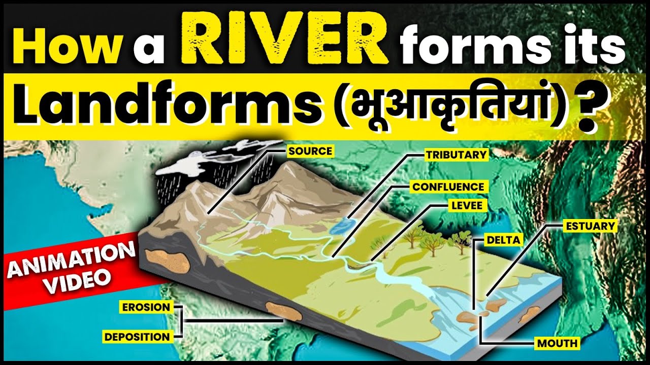
Deltas form at the end of a river's journey, where it empties into a quiet body of water like an ocean or sea.
- (a) River mud and sand drop at the coast and spread out into the sea water.
- (b) Sediments drop in neat layers: heavy sand drops first near the coast, while light silt and fine clay float further out into open water.
- (c) As sediment keeps piling up, the river splits into new streams, pushing the new land further out into the sea.
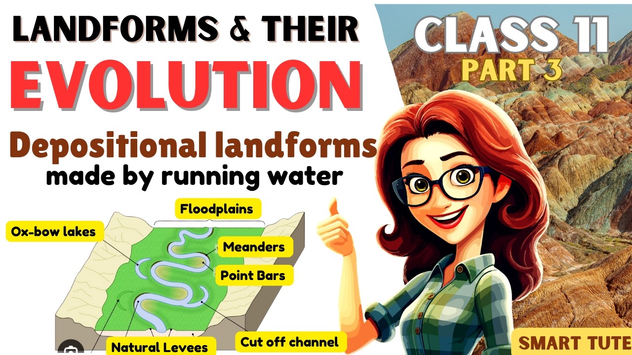
Floodplains, Natural Levees, and Point Bars: Features of River Plains
Slow rivers flowing across flat lowlands create wide plains built from sediment dropped during seasonal flood events.
- Floodplains: Flat areas made of fine sand and mud dropped by river water. The active floodplain is the normal river bed, while the inactive floodplain sits higher up and receives water only during major floods.
- Natural Levees: Raised ridge walls made of coarse sediments that build up naturally along river banks when flood waters spill over.
- Point Bars: Curved deposits of sand and gravel formed on the inside curve of a winding river bend where water flows slowly.
Meanders and the Formation of Ox-bow Lakes
Winding river loops show how water shifts sideways across broad, flat plains.
- (i) Winding channel patterns form because water pushes sideways across flat plains.
- (ii) Fast water scrapes away the outer river bank, while slow water drops sediment along the inner bank.
- (iii) The outer bank forms a steep edge called a cut-off bank. When a winding loop bends too far, the river cuts straight through the narrow neck during floods, leaving behind a curved pond called an oxbow lake.

Meander and cut-off loops, explaining the process that leads to the creation of oxbow lakes when rivers change their course. 
Meander loop, illustrating how river erosion shapes winding curves in its course.
Groundwater as a Geomorphic Agent and the Formation of Karst Topography
Rainwater that soaks into the soil becomes groundwater. It slowly dissolves soft underground rocks, shaping a special landscape known as Karst topography.
Groundwater and Chemical Weathering: The Power of Solution
Underground water alters landscapes mostly through chemical dissolving, called solution, and mineral dropping, called precipitation.
- (i) Water seeps down through tiny cracks and joints in porous rock layers.
- (ii) Groundwater does not wear away rock by pushing it physically. Instead, it slowly dissolves soft rocks made of calcium carbonate, like limestone and dolomite.
- (iii) The resulting landscape of underground hollows and surface sinkholes is called Karst topography, named after the famous Karst region in the Balkans.

Karst features, showing geological formations like stalactites, stalagmites, uvalas, and sinkholes in limestone areas. Erosional Landforms of Karst Regions: Sinks and Grooves
Dissolving limestone underground creates visible bowl-shaped holes and deep slots on the land surface above.
- (a) Swallow Holes and Sinkholes:Swallow holes are shallow, round hollows formed where water dissolves top rock. Sinkholes are deep, funnel-shaped holes. Solution sinks form purely by chemical dissolving, while collapse sinks form when a cave roof falls in.
- (b) Valley Sinks (Uvalas): When several sinkholes dissolve and join together into one giant trench, they form a large surface depression called an uvala.
- (c) Lapies and Limestone Pavements: When water dissolves rock along parallel cracks, it forms a surface of sharp ridges and deep grooves called lapies. Over time, these smooth out into bare rock fields called limestone pavements.
Cave Formation: Subsurface Dissolution Tunnels
Water flowing sideways through underground rock cracks slowly dissolves large hollow rooms, creating hollow limestone caves.
- (i) Caves develop along underground rock cracks as acidic water dissolves stone away over long periods.
- (ii) Underground streams often flow through these hollow rooms. If an underground cave opens up at both ends, it is called a tunnel.
Depositional Landforms in Caves: Speleothems
Inside cave rooms, dripping water leaves behind tiny bits of dissolved calcium carbonate. Over time, these mineral drips build stone shapes called speleothems.
- Stalactites, Stalagmites, and Pillars:Stalactites hang down like sharp icicles from the cave ceiling. Stalagmites grow upwards from the cave floor where water drips down. When a hanging stalactite joins a rising stalagmite, they fuse together into solid rock columns and pillars.

Stalactites and stalagmites, depicting mineral formations in caves created by dripping water rich in dissolved minerals.
Conclusion: The Enduring Impact of Geomorphic Agents on Earth's Surface and Student Relevance
Both running water and groundwater play vital roles in shaping Earth's landscape. River water carves erosional landforms like V-shaped valleys and builds depositional features like floodplains and oxbow lakes across distinct landscape stages. Meanwhile, groundwater dissolves rock to create Karst topography with sinkholes, caves, and cave dripstones like stalactites and stalagmites. Understanding these geomorphic agents and their landforms provides foundational knowledge for students preparing for physical geography tests and school exams.
⚡ Quick Revision Capsule: Landform Features
Use this quick guide to review key landforms built by river water and groundwater:
| Geomorphic Agent | Erosional Landforms | Depositional Landforms |
|---|---|---|
| Running Water (Youth Stage) | V-shaped valleys, Gorges, Canyons, Waterfalls, Rapids, Potholes, Plunge pools | Minimal sediment deposition |
| Running Water (Mature Stage) | Deeper valleys, early side cuts, initial Meanders | Early Floodplains, Point bars |
| Running Water (Old Stage) | Incised meanders, Cut-off banks | Broad floodplains, Oxbow lakes, Natural levees, Deltas |
| Mountain Streams / Outlets | Gullies, Rills | Alluvial fans (cone-shaped deposits at mountain bases) |
| Groundwater (Karst Regions) | Sinkholes, Swallow holes, Uvalas, Lapies, Caves, Underground tunnels | Stalactites (ceiling), Stalagmites (floor), Cave pillars and columns |
📝 Summary
Over , running water and underground flow carve valleys, caves, and plains across the globe. Books like Fundamentals of Physical Geography highlight how rivers move from steep youth stages down to flat old-age floodplains, while acidic groundwater dissolves underground limestone to construct marvelous Karst caverns.
🚀 Quick Revision Points
Essential facts to review before examinations:
- (i) Sheet erosion removes soil evenly, turning into tiny rills, deep gullies, and finally wide valleys.
- (ii) Youth stages feature fast water and sharp V-shaped valleys, while Old stages show flat floodplains and winding oxbow lakes.
- (iii) Groundwater dissolves limestone rocks to create Karst topography full of hollow sinkholes and caves.
- (iv) Inside limestone caves, stalactites grow down from the ceiling while stalagmites rise up from the floor, as detailed in Physical Geography Principles.
- 💡 Exam Tip: Remember: StalacTites grow down from the Top (ceiling), while StalagMites grow up from the Middle floor!
❓ Frequently Asked Questions (FAQ)
Q1: What is the main difference between a gorge and a canyon?
A1: A gorge is very steep and narrow with straight rock walls, while a canyon is step-like and much wider at the top than at the bottom.Q2: How does an oxbow lake form?
A2: An oxbow lake forms when a winding river loop cut-off occurs during high water, trapping a curved pool of standing water away from the main river path.Q3: What kind of rock is required to form Karst topography?
A3: Karst topography requires soluble rocks rich in calcium carbonate, such as limestone or dolomite, as mentioned in geological surveys.