This detailed analysis explores the complexities of India's international boundaries, focusing on the highly contested Indo-Pakistan boundary. Understanding these territorial disputes, including regions like Jammu and Kashmir, the Siachen Glacier, and Sir Creek, is vital for students preparing for geography, polity, and international relations examinations, providing key insights into South Asian geopolitics.
🎯 In this chapter, you will understand:
- The geopolitical impact of the post-1947 partition on India's international borders.
- The history and persistent controversies surrounding the Radcliffe Line.
- Major disputed regions including Jammu & Kashmir, Siachen Glacier, and Saltoro Ridge.
- The coastal demarcation challenges and legal claims involving Sir Creek.
💡 Why this topic matters: Border studies form a core pillar of strategic awareness, geography, and international diplomacy for national examinations.
🧠 Core Idea: Historical partitions, territorial claims, and military lines shape India's national security and regional stability in South Asia.
Geopolitical Analysis of India’s International Boundary Disputes and Peaceful Borders (Post-1947 Partition Era)
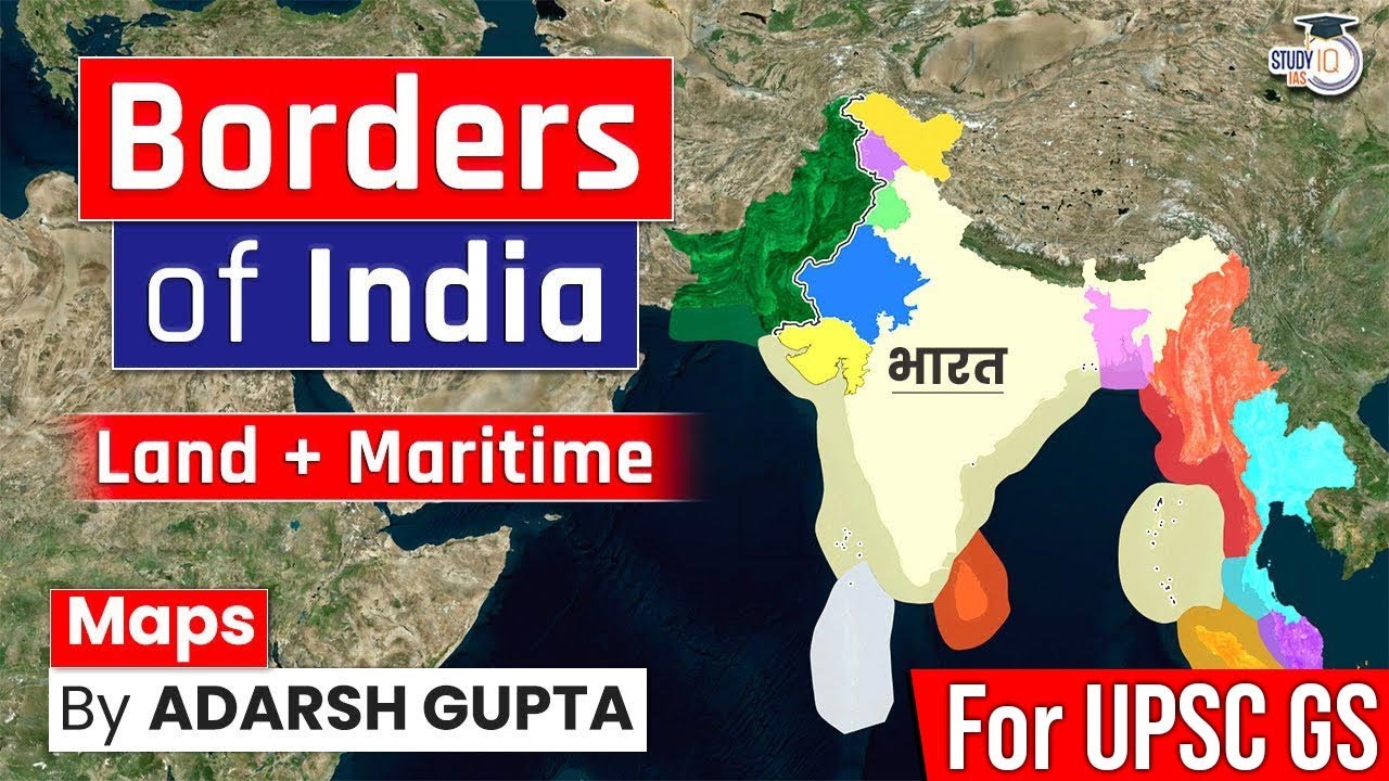
A comparative study of India's boundaries reveals a wide spectrum of relationships, ranging from complete tranquility with its Himalayan neighbor to enduring conflict shaped by historical partitions.
The vast network of India's borders provides a critical lens through which to view its foreign policy and security challenges, impacting regional stability and internal governance.
- (i) The borders define India's geographical and political limits, influencing its trade, defense strategy, and cultural exchanges with adjacent nations.
- (ii) Historical events, primarily the Partition of 1947, have indelibly marked certain boundaries, leading to persistent, internationally recognized disputes.
- (iii) The concept of boundary demarcation often rests on varying interpretations of colonial-era agreements or the realities established through military control.
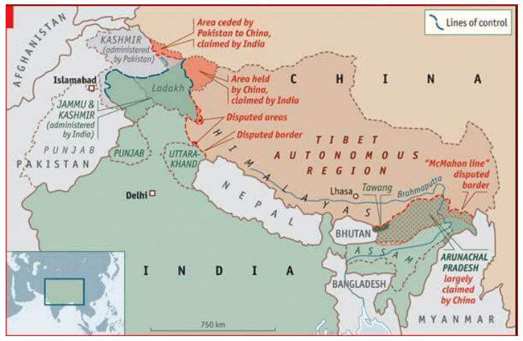
Indo-Pakistan Boundary: The Legacy of the Radcliffe Award
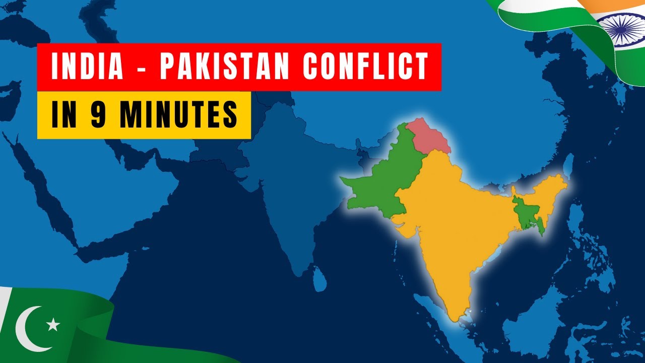
The boundary separating India and Pakistan is a volatile frontier, a direct outcome of the hurried and arbitrary nature of the , leading to enduring territorial conflicts.
Origins of the Indo-Pak Border: The Radcliffe Line
The line was officially designated under the Radcliffe Award, named after its chairman, Sir Cyril Radcliffe, who was tasked with dividing millions based on religious majority. This poorly demarcated line instantly created complex issues, particularly in regions where populations were mixed, leading to the major disputed regions that persist today.
- (i) Key conflict areas include Jammu and Kashmir and the maritime-related swampy area of Sir Creek.
- (ii) The boundary has been the site of multiple wars and continuous military engagement since its inception in .
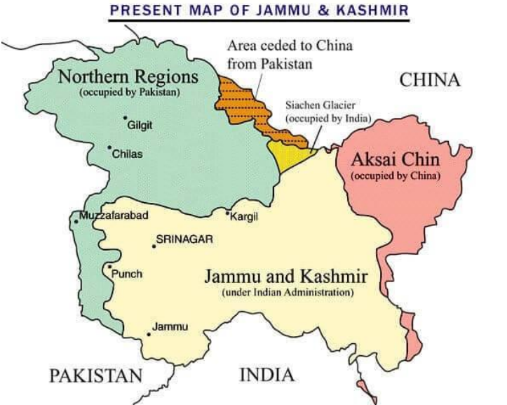
Major Disputed Territories Along the India-Pakistan Border
Several critical territories remain points of intense geopolitical friction, underscoring the deep ideological and political differences between the two nuclear-armed states.
Overview of Key Disputed Zones:
- (i) Jammu and Kashmir (J&K), Pakistan-occupied Kashmir (PoK), and Gilgit Baltistan: This is the most complex dispute, involving vast tracts of land. India asserts that approximately 78,000 sq. km of its territory in Jammu and Kashmir is under the illegal and forcible occupation of Pakistan. Furthermore, a highly contentious point is the transfer of 5,180 sq. km in Pakistan Occupied Kashmir to China under the so-called Sino-Pakistan Boundary Agreement of 1963, which India views as an illegal cession.
- (ii) Siachen Glacier: This strategically vital area, located in the eastern Karakorams, lies just east of the Actual Ground Position Line (AGPL). Despite being a contested region, the entire Siachen Glacier and all its major passes have been under the administration of India since the successful Operation Meghdoot in , highlighting a crucial military advantage for India.
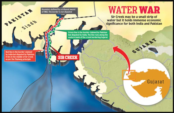
Sir Creek dispute - (iii) Saltoro Ridge: These mountains, a subrange of the Karakoram Heights, are positioned on the southwest side of the Siachen Glacier. The ridge is claimed by India as part of Jammu and Kashmir Union Territory and by Pakistan as part of Gilgit-Baltistan. Following the operation, India secured military control of the main peaks and passes, with Pakistani forces relegated to the glacial valleys to the west, establishing the current ground reality.
Sir Creek: The Coastal Demarcation Challenge
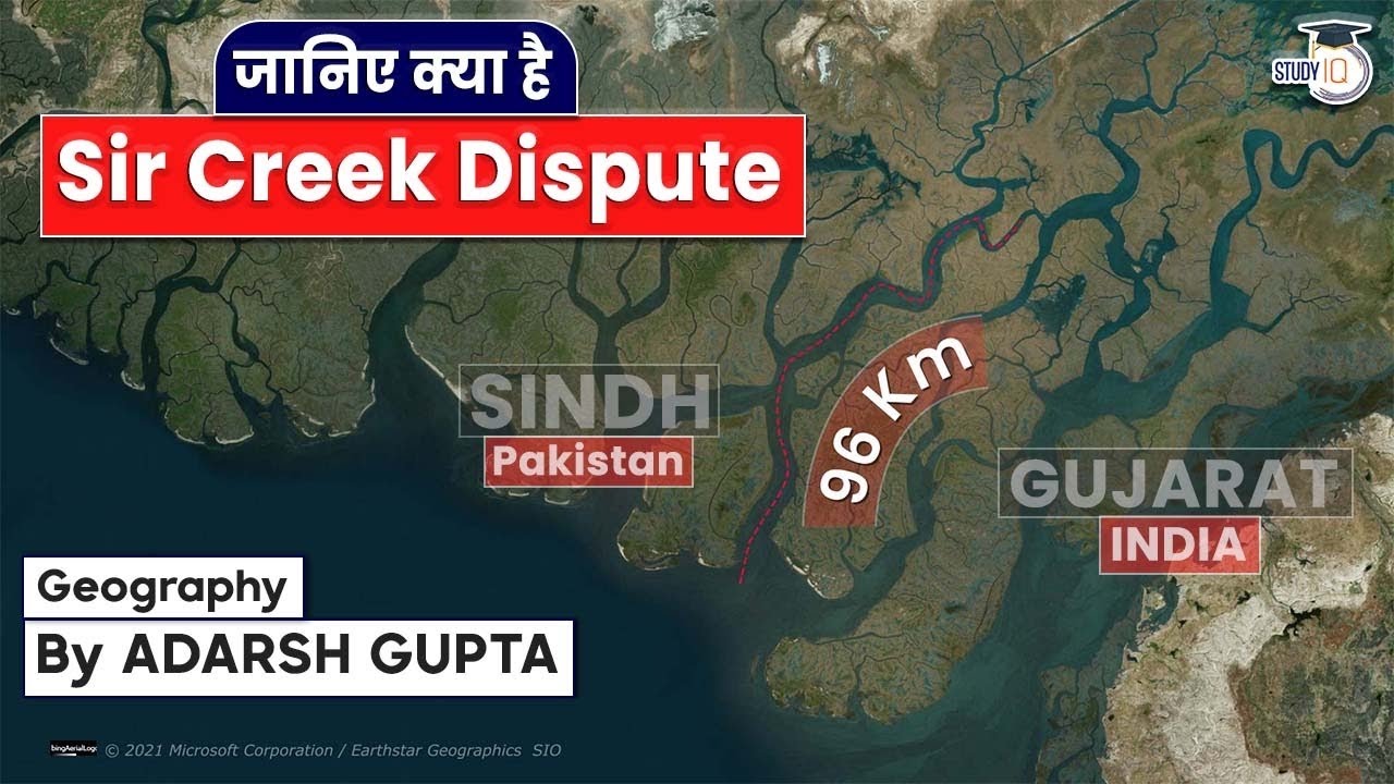
- (a) Sir Creek is a 96 km long strip of water running through the marshlands of the Rann of Kutch, representing a critical, unresolved maritime boundary issue.
- (b) The core disagreement stems from differing interpretations of the Bombay Government Resolution of 1914, with Pakistan claiming the eastern bank while India advocates for the internationally recognized thalweg doctrine (centerline rule).
- (c) Due to this fundamental disagreement, the International Boundary in the Sir Creek area and the International Maritime Boundary Line (IMBL) between the two nations remain officially undemarcated.
⚡ Quick Revision Capsule: India-Pakistan Boundary Highlights
A structured breakdown of the primary contested areas, key historical agreements, and present-day status along the border.
| Disputed Region | Key Legal / Historical Framework | Current Operational Status |
|---|---|---|
| Jammu & Kashmir / PoK | Radcliffe Award & Sino-Pakistan Boundary Agreement of 1963 | 78,000 sq. km under illegal occupation of Pakistan; 5,180 sq. km illegally ceded to China. |
| Siachen Glacier | Actual Ground Position Line (AGPL) | Under full Indian administration following Operation Meghdoot in . |
| Saltoro Ridge | Karakoram Heights subrange boundary claims | India controls main peaks and passes; Pakistani forces remain in western glacial valleys. |
| Sir Creek | Bombay Government Resolution of 1914 vs thalweg doctrine | 96 km strip in Rann of Kutch; IMBL remains completely undemarcated. |
📝 Summary
India's international boundaries carry deep geopolitical weight, shaped significantly by the partition and ongoing territorial differences. The border with Pakistan remains a key focus area due to long-standing military and territorial disputes across Jammu and Kashmir, high-altitude strategic posts at Siachen, and maritime challenges along Sir Creek.
🚀 Quick Revision Points
Essential facts to review before examinations:
- (i) The border line was established via the Radcliffe Award under Sir Cyril Radcliffe during the Partition.
- (ii) Pakistan illegally occupies about 78,000 sq. km in J&K and illegally transferred 5,180 sq. km to China in .
- (iii) India controls the Siachen Glacier and Saltoro Ridge peaks following Operation Meghdoot in .
- (iv) The 96 kmSir Creek dispute centers on whether to use the eastern bank claim or the thalweg doctrine.
- 💡 Exam Tip: Focus on understanding the legal distinction between the Line of Control (LoC), the Actual Ground Position Line (AGPL), and the International Maritime Boundary Line (IMBL) when answering subjective exam questions.
📝 Conclusion: Why Studying Border Disputes is Crucial for Exam Preparation
The study of India's international boundaries is indispensable for grasping the nation's geopolitical challenges and strategic depth. The volatile, historically charged Indo-Pakistan boundary—specifically over regions like Jammu and Kashmir, Siachen Glacier, and Sir Creek—offers profound insights into South Asian security dynamics. For students, mastering the details of the Radcliffe Award, the Operation Meghdoot, and the specifics of the undemarcated maritime boundary is key to excelling in competitive examinations that test knowledge of Indian Geography and International Relations.
❓ Frequently Asked Questions (FAQ)
Q1: What is the Radcliffe Line?
A1: It is the boundary line demarcated by Sir Cyril Radcliffe in to divide British India into India and Pakistan.Q2: What is the significance of Operation Meghdoot?
A2: Launched in , Operation Meghdoot gave India military control over the entire strategic Siachen Glacier and its major mountain passes.Q3: What is the main legal conflict in the Sir Creek issue?
A3: Pakistan claims the entire eastern bank based on a resolution, whereas India advocates using the international thalweg doctrine along the navigable channel centerline.