The massive sweep of the Harappan culture is best understood by examining its incredible spread across the modern-day Indian subcontinent. Flourishing during the Bronze Age, this ancient urban marvel reveals sophisticated city infrastructure, exceptional civic engineering, and highly organized trade networks. By mapping its widespread settlements, we uncover how ancient communities established thriving, uniform cities across vast geographical zones, laying down foundational concepts for early civil planning and sanitation that remain highly influential today.
In this chapter, you will understand:
- The total geographical extent and extreme territorial borders of the Indus Valley Civilization (IVC).
- The urban planning models, grid networks, and bipartite structural divisions of key cities like Harappa and Mohenjo-daro.
- Iconic public utilities and architectural features, including the famous Great Bath, maritime dockyards, and large-scale granaries.
- The engineering innovations of the Harappans, specifically their standardized baked brick construction and meticulous drainage networks.
Why this topic matters: This subject forms a core pillar of ancient history studies and is highly critical for competitive examinations. Understanding the Harappan civilization helps unpack how early human societies successfully managed resources, built resilient infrastructure, and navigated vast environmental landscapes without advanced modern machinery.
Core Idea: The Indus Valley Civilization represents a milestone in ancient urban living, characterized by its wide territorial expanse and uniform city layouts. Major urban spots used uniform grid street plans, distinctive citadels, and public health systems. Through systematic excavations at sites like Lothal, Kalibangan, and Rakhigarhi, we witness a highly organized society focused on utility, sanitation, and shared cultural practices.
Vast Territorial Reach of the IVC
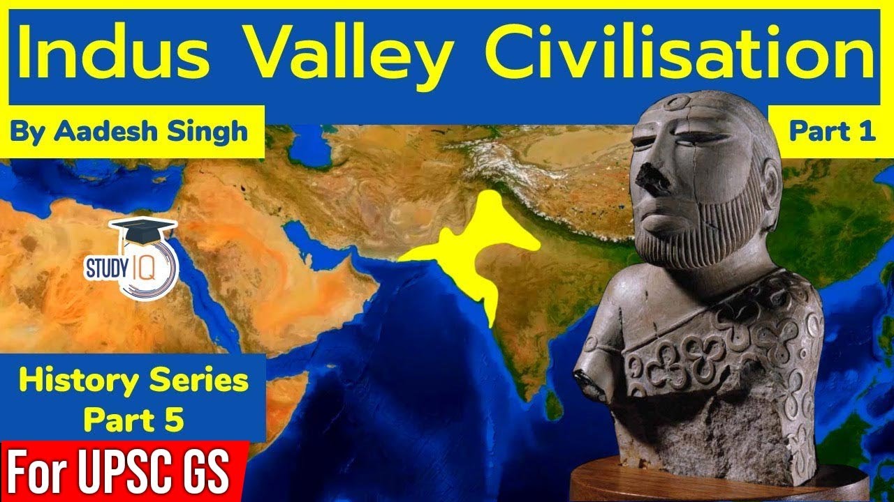
The Indus Valley Civilization holds the proud distinction of being one of the most geographically expansive ancient cultures in human history. Its widespread territorial boundaries connected completely different landscapes into a unified cultural sphere.
Territorial Extent and Societal Unity
The geographical extent confirms the IVC's complete dominance over a massive region, marking it as an unprecedented phenomenon in the prehistoric Bronze Age world.
- The sheer continuity of Harappan culture across such a highly diverse geography proves there was a strong, unified societal structure guiding its growth.
- Understanding this extensive coverage gives ancient history students crucial insights into how efficiently these early trade routes and administrative centers must have run.
Major Cities and the Urban Planning Marvels of Harappan Settlements
The core of the IVC's long-lasting success lay right within its carefully engineered urban centers, which demonstrated an advanced grasp of civic design entirely unmatched for its era.
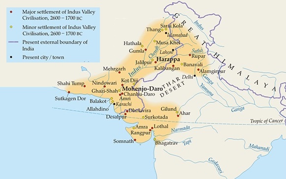
- Key Urban Centers: Prime historical settlements such as Harappa and Mohenjo-daro located in modern Pakistan, along with Lothal in Gujarat, Kalibangan in Rajasthan, and Rakhigarhi in Haryana (which stands as the largest site found so far) perfectly showcase the classic traits of Harappan culture.
Grid Networks and Bipartite Divisions
Cities universally utilized a structured network to optimize daily transportation, emergency movement, and waste disposal systems across both residential and administrative zones.
- Structured Layout: All major cities strictly adopted a highly sophisticated grid system of streets, intentionally designed to intersect at precise right angles for neat organization.
- Bipartite Division: Most urban areas, including Mohenjo-daro, featured a clean two-part division: a fortified elevated area known as the citadel (or acropolis) alongside a completely separate lower town built for the general public.
- The specialized citadel at the Kalibangan site featured its own distinct bipartite plan, supported structurally by six prominent mud-brick platforms.
Iconic Architectural Features and Advanced Infrastructure
An unwavering commitment to community utility and public welfare is highly obvious when analyzing the monumental structures unearthed inside Harappan cities. This reflects an exceptionally capable civic administration centered around public health and collective resource distribution.
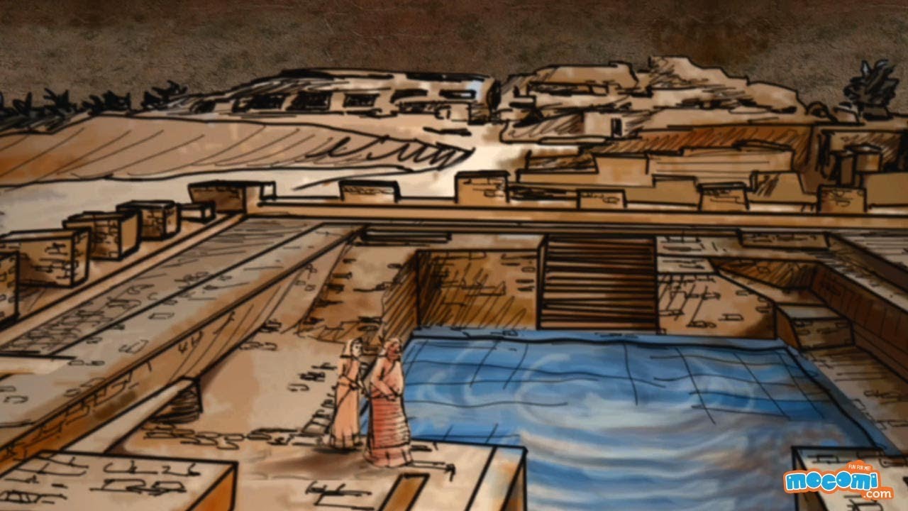
- The Great Bath: The monumental Great Bath situated at Mohenjo-daro features a large, secure tank measuring exactly 11.88m × 7.01m. It is widely considered the earliest known public water tank in the world and most likely served important ceremonial or purification rituals.
Resource Storage and Engineering Markers
Advanced architectural techniques ensured the preservation of vital food supplies and enabled active long-distance maritime trading with neighboring global civilizations.
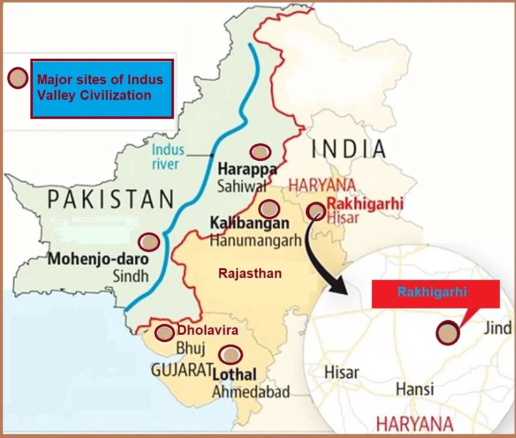
Detailed map overview outlining the primary urban centers of the Harappan culture - Resource Storage: Massive granaries and heavy brick platforms were vital pieces of infrastructure in core hubs like Harappa, showing a centralized method for safeguarding agricultural surpluses.
- Building Material: The widespread, standardized implementation of baked bricks for housing, along with incredibly detailed, interconnected drainage systems, remains a lasting hallmark of the IVC's structural engineering.
- Unique Discoveries: The coastal site of Lothal is world-famous for its massive excavated tidal dockyard, while Kalibangan yielded rare evidence of early furrowed land, and Harappa stands out for its organized workmen's quarters.
Harappan Civilization Quick Revision Capsule
Review this concise mapping of core excavated sites, their defining architectural elements, and primary archaeological findings:
| Excavated Site | Key Strategic Infrastructure | Core Archaeological Feature |
|---|---|---|
| Mohenjo-daro | The Great Bath water tank | Bipartite town layout with elevated citadel |
| Harappa | Large centralized granaries | Dedicated, structured workmen's quarters |
| Lothal | Tidal maritime dockyard basin | Advanced hub for coastal trading operations |
| Kalibangan | Six structural mud-brick platforms | Clear evidence of early historic furrowed land |
| Rakhigarhi | Extensive residential networks | Stands as the largest known site of the IVC |
Summary
The Indus Valley Civilization remains an iconic example of early human innovation, urban sophistication, and civic responsibility. From their disciplined grid street layouts to complex wastewater management systems, the Harappans prioritized community health and efficient trade over grand royal monuments. The uniform distribution of materials, like their standardized baked bricks, across a immense geographical territory points to an incredibly cohesive administration that effectively united one of the greatest cultures of the prehistoric Bronze Age.
Quick Revision Points
Keep these essential historical takeaways in mind for rapid study:
- (i) Harappa and Mohenjo-daro were the twin anchor cities, utilizing clear citadels and grid layouts.
- (ii) The Great Bath at Mohenjo-daro measures 11.88m × 7.01m and is the earliest known public water tank.
- (iii) Lothal served as a crucial maritime center featuring an engineered artificial dockyard for ocean trade.
- (iv) Standardized baked bricks and fully covered, interconnected drainage networks ran through almost every settlement.
- Exam Tip: Always remember that Rakhigarhi is currently recognized as the largest geographic site of the Indus Valley Civilization. Pay close attention to site-specific discoveries for matching questions, such as linking Lothal to the dockyard and Kalibangan to furrowed fields.
Frequently Asked Questions (FAQ)
Q1: What is the classic layout structure observed in major Harappan cities?
A1: Most Harappan cities followed a distinct bipartite layout consisting of an elevated, fortified citadel for administrative or religious functions and a spacious lower town designed for residential use by the regular public. The streets were organized via a precise grid system intersecting at right angles.Q2: Why is the Great Bath of Mohenjo-daro considered an engineering marvel?
A2: Measuring 11.88m × 7.01m, it is historically recognized as the earliest public water tank ever built. It showcases exceptional waterproofing through tightly fitted bricks and natural tar, likely serving important ritual purification or ceremonial roles for the community.Q3: Which Harappan sites are famous for maritime trade and agricultural insights?
A3: Lothal in Gujarat is famous for its unique excavated tidal dockyard that connected the city to ancient marine trade routes. Meanwhile, Kalibangan in Rajasthan provides crucial agricultural insights through the discovery of early prehistoric furrowed land.